Vatnajokull glacier volcano: Europe’s largest ice cap, covering 8% of Iceland’s surface with ice up to 950 metres thick. Beneath it, several active volcanoes continue to erupt. When volcanic heat meets glacial ice, it triggers subglacial floods of extraordinary force. Vatnajokull is where fire and ice are not opposites. They are the same story, told from two directions.
Vatnajokull Glacier Volcano: Europe’s Largest Ice Cap
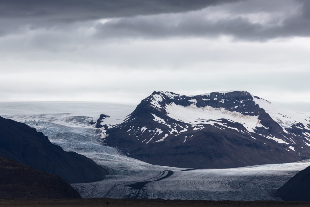
Vatnajokull glacier volcano covers 7,900 square kilometres. Put it over France and it would cover an area larger than the Paris region. Its average thickness is 400 metres. At its deepest point, beneath the Grimsvötn caldera, the ice reaches 950 metres. That is nearly the height of three Eiffel Towers stacked on top of each other.
This is not a mountain glacier. It is an ice cap, a dome of ice so massive it flattens everything beneath it. Ridgelines, valleys, even volcanic calderas disappear under its weight. From above, the surface looks almost featureless. From the edge, where the glacier meets the sea at Jökulsárlón, it calves icebergs the size of houses into a lagoon of extraordinary blue.
Vatnajokull holds roughly 3,100 cubic kilometres of ice. That represents about 10% of all freshwater stored in glaciers outside the polar regions. It is, by almost any measure, one of the most significant bodies of ice on Earth outside Greenland and Antarctica.
What makes it unlike any other ice cap is what lies beneath it.
Fire Underneath, Ice on Top
Below Vatnajokull, the Earth is not cold. It is exceptionally hot. The ice cap sits directly above one of Iceland’s most active volcanic zones, a section of the Mid-Atlantic Ridge where magma rises close to the surface and has done so for millions of years.
Grimsvötn is the most active volcano in Iceland. It erupts roughly every five to ten years. Its caldera sits under 200 metres of ice. When it erupts, the lava does not emerge into open air. It melts the ice above it from below, creating a lake of meltwater that builds pressure until the system releases.
Bardarbunga is the largest volcanic system under the ice, with a caldera 80 kilometres long. In 2014, it triggered a fissure eruption at Holuhraun, north of the glacier, that produced more lava than any Icelandic eruption since 1783. The eruption lasted six months and released more sulphur dioxide than all of Europe’s industry combined during that period.
These two systems, fire and ice, are not in opposition. They are in constant conversation. The ice moderates the eruptions. The eruptions reshape the ice. The result is a landscape unlike anything else on the planet.
When The Ice Breaks: The Jökulhlaup
The Icelandic word jökulhlaup means, literally, glacier run. It describes what happens when meltwater trapped beneath a glacier builds to a point where the ice dam holding it can no longer hold. The release is sudden and violent.
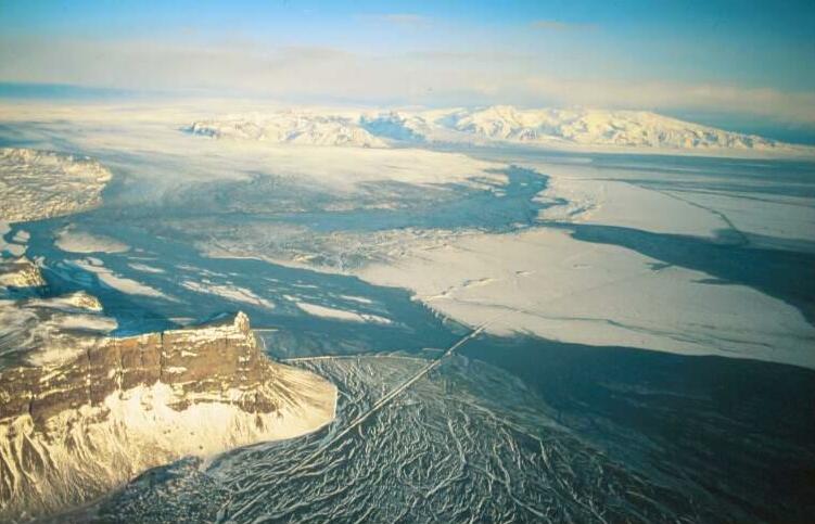
During the 1996 Grimsvötn eruption, a jökulhlaup released an estimated 45,000 cubic metres of water per second at its peak. For reference, the average flow of the Amazon River is 209,000 cubic metres per second. The jökulhlaup reached roughly a fifth of that in hours, from a single glacier in a country the size of Kentucky.
The flood swept across the Skeidarársandur, a vast outwash plain south of the glacier, destroying bridges and depositing boulders the size of cars across the coastal plain. The event lasted two days. The landscape it left behind looked like a different planet.
Jökulhlaups are not rare events in Iceland’s history. They have shaped the entire southern coast. The broad, flat plains you see driving Ring Road south of Vatnajokull are the accumulated deposits of thousands of years of glacial floods. The land you drive on was built by ice and fire working together.
Vatnajokull Glacier Volcano: What It’s Telling Us
Vatnajokull is retreating. Since 1890, it has lost roughly 10% of its volume. In the past three decades, the rate has accelerated. The glacier currently loses an estimated 10 billion tonnes of ice per year, equivalent to filling about four million Olympic swimming pools annually.
Some outlet glaciers, the tongues of ice that flow down from the main ice cap into valleys, are retreating at 40 to 100 metres per year. In geological terms, this is extremely fast. In human terms, you can observe the change between two visits spaced a decade apart.
As the ice retreats, the land beneath rises. Iceland is experiencing what geologists call isostatic rebound: the crust, relieved of the weight of ice it has carried for millennia, slowly springs back upward. Some areas of Iceland are rising by up to 30 millimetres per year. The island is, in a measurable sense, growing taller as it loses its ice.
There is a further consequence. Less ice means less pressure on the volcanic systems below. Reduced pressure lowers the melting point of rock, which can increase volcanic activity. The relationship between glacial retreat and volcanism in Iceland is an active area of research. Vatnajokull is both a victim of change and a participant in it.
How To Read Vatnajokull Glacier Volcano
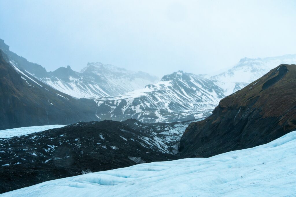
Most visitors encounter Vatnajokull through its edges. Jökulsárlón glacier lagoon, at the southeastern corner of the ice cap, is where the glacier meets the sea. Icebergs calve from the glacier front, drift slowly across the lagoon, and wash up on Diamond Beach as translucent blocks on black sand. The colours shift through every shade of blue and white depending on the light and the density of the ice.
Ice cave tours operate in winter from the eastern outlets, particularly around the Breidamerkurjokull glacier. The caves form when meltwater carves tunnels through the lower layers of the glacier. Inside, the ice is compressed to the point where it absorbs all wavelengths of light except blue. The ceiling glows. The silence is total. You are inside a geological process.
Glacier hiking on Vatnajokull requires a guide. The surface is crossed by crevasses that are not visible from above and can be several metres deep. What looks like a flat white plain is, in reality, a dynamic structure moving 50 to 200 centimetres per day. The glacier is not standing still. It is flowing, cracking, melting, and refreezing on a timescale too slow for a single visit to capture.
What the glacier asks of a visitor is patience and attention. Not dramatic gestures. Just the willingness to look at something old and cold and moving, and to understand that what you are seeing is Iceland’s most honest conversation with its own future.
The Argument The Ice Is Making
Vatnajokull is not a backdrop. It is an active participant in Iceland’s geology, its climate, and its future. The ice shapes the volcanoes below it. The volcanoes reshape the ice above them. The floods they produce together have built the coastline you see on every map of southern Iceland.
To visit it is to stand at the intersection of deep time and current change, in a place where you can see both simultaneously. The icebergs floating in Jökulsárlón contain air bubbles trapped centuries ago. The lava beneath the glacier is the same system that has been running for millions of years.
Dettifoss, 300 kilometres to the north, offers a different lesson about what water does when it has enough time and force. The two places, read together, tell the complete story of Iceland’s south.
Frequently Asked Questions
Can You Walk on Vatnajokull Glacier?
Yes, but only with a certified glacier guide. The surface contains crevasses that are not visible from above and can be dangerous without proper equipment and local knowledge. Guided hikes depart daily from Skaftafell and Jokulsarlon during the summer months.
What Volcano Is Under Vatnajokull?
Several volcanic systems lie beneath the ice cap. Grimsvötn is the most active, erupting roughly every five to ten years. Bardarbunga is the largest, with a caldera 80 kilometres long. Both have erupted within the past 30 years and remain closely monitored.
Is Vatnajokull Melting?
Yes. The glacier has lost approximately 10% of its volume since 1890, and the rate of loss has accelerated in recent decades. It currently loses an estimated 10 billion tonnes of ice per year. Some outlet glaciers are retreating at 40 to 100 metres annually.
What This Place Teaches
What This Place Teaches
Vatnajokull shows that fire and ice are not opposites. They are the same geological system, responding to each other in real time, across thousands of years and hundreds of metres of frozen water.
For Young Explorers
Find Jökulsárlón on Google Earth and compare images from 2000 and today. Can you see how the lagoon has grown as the glacier retreated? Measure the difference in kilometres.
The Deep Time Angle
The ice in Vatnajokull began forming roughly 2,500 years ago, during a cold period in Iceland’s history. The air bubbles trapped inside the oldest ice carry a sample of the atmosphere from before written Icelandic history began.
Further Reading
Book: The Ice at the End of the World by Jon Gertner. App: Veðurstofa Íslands (Icelandic Met Office, real-time eruption monitoring). Scientific reference: Björnsson & Pálsson, 2008, Icelandic glaciers, Jökull Journal.
Pingback: Dettifoss: Why Europe’s most powerful waterfall exists here and nowhere else - Geonatra
Pingback: Iceland’s arctic moss: Why the ground beneath your feet Is 1,000 years old - Geonatra
Pingback: Snaefellsnes: The Volcano That Inspired Jules Verne and Shaped an Island’s Edge - Geonatra
Pingback: Standing on two continents: the Silfra rift and Iceland’s tectonic secret - Geonatra
Pingback: Ring Road: 7 geological stops that explain how Iceland was built - Geonatra
Pingback: Iceland’s Geological Places: Guide to Most Significant Sites
Pingback: Dettifoss: The Waterfall That Moves - Geonatra
Pingback: Iceland Volcanic Rift: The Seam That Built Earth