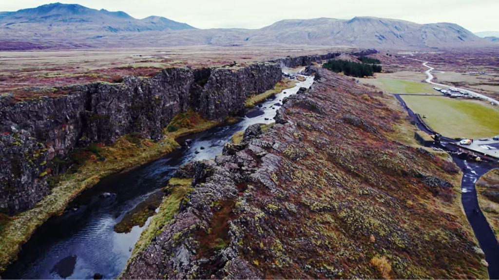
The water is 2°C. You can feel it through the drysuit, a slow, bone-deep cold that makes you breathe deliberately. Below you, the bottom drops away into a blue so clear it doesn’t look real. The walls on either side are close enough to touch — dark basalt, slick and ancient, rising from the floor of Þingvallavatn lake like the sides of a wound that never closed.
You are not in a canyon. You are in a crack in the Earth.
And the two walls you could reach out and touch? They are on different continents.
An Island Born at the Crossroads of Two Forces
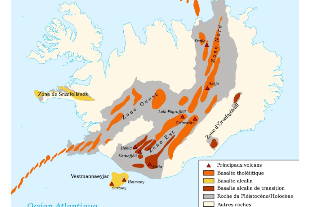
Most people know Iceland sits on a volcanic hotspot. Fewer realize it also straddles one of the longest mountain ranges on the planet — the Mid-Atlantic Ridge, a 16,000-kilometer rift running along the floor of the Atlantic Ocean from the Arctic to the South Atlantic.
This ridge is where the North American and Eurasian tectonic plates pull apart. Normally, this happens underwater, invisible, unvisited. Iceland is the one place on Earth where the ridge rises above sea level. The country doesn’t just sit near a plate boundary. It is the plate boundary.
At Silfra, inside Þingvellir National Park, that boundary becomes a place you can swim through.
How a Crack in the Ground Fills with Glacier Water
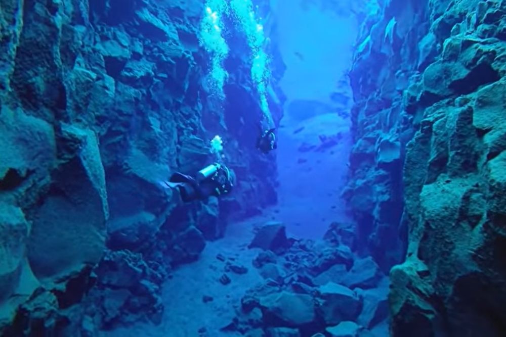
Silfra isn’t just a tectonic fissure. It’s also one of the clearest bodies of water in the world, which is what makes it so disorienting — you can see every detail of the rock walls 30 meters below your fins.
The water comes from Langjökull glacier, about 50 kilometers to the north. But it doesn’t arrive quickly. It seeps down through layers of porous lava rock, filtered slowly over 30 to 100 years before it reaches Silfra. By the time it fills the fissure, it’s been purified so thoroughly that visibility can exceed 100 meters on a calm day.
The fissure itself opened because the two plates don’t drift apart smoothly. They move in jolts. Earthquakes crack the surface, and over centuries those cracks widen into the channels and caverns that divers now explore. Silfra has been growing, slowly and measurably, for millions of years.
The Arithmetic of Deep Time
Two centimeters per year. That’s how fast the North American and Eurasian plates are separating at this latitude.
It doesn’t sound like much. But multiply two centimeters by 60 million years, the approximate age of the Atlantic Ocean’s opening at this point and you get roughly 1,200 kilometers of total separation. The ocean between Iceland and Greenland exists because of that slow, relentless drift. The same drift that created Silfra is still widening it, right now, while you float above its floor.
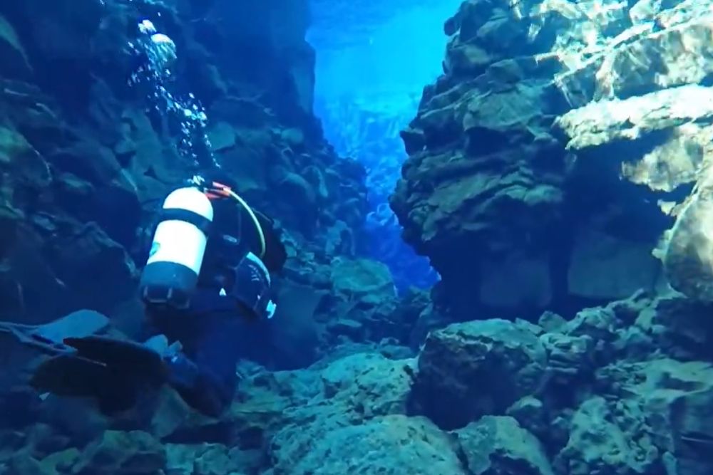
This is what geologists mean when they talk about deep time. Not a distant abstraction, but a process you can measure with your hands. At Silfra, the gap between the two basalt walls is wide enough to extend your arms and press your palms flat against both continents simultaneously. People do this. It’s probably the most geologically significant stretch most of us will ever make.
For more on Iceland’s formation and the timescales involved, the article on Vatnajökull covers the long relationship between ice, fire, and geological age on the island.
What You Actually See Underwater
The Silfra dive is divided into three sections, each with a different character.
The Silfra Hall is the deepest part, where the fissure opens into a wide chamber and the water takes on that impossible blue. The Silfra Cathedral narrows and the walls rise above you, channeling light in columns. The Silfra Lagoon at the end is shallow, warmer, where the rock gives way to green algae that locals call “troll hair”.
Throughout the dive, the basalt on your left formed on the North American plate. The basalt on your right formed on the Eurasian plate. They are the same rock type, both created by the same volcanic processes that built Iceland, but they have been drifting apart since before our species existed.
If you want to understand what that rock looks like up close and what it tells you about Iceland’s volcanic history, the guide to basalt, obsidian, and lava fields is a useful reference before you go.
Standing on Two Continents: What It Actually Means
There’s a specific moment that most Silfra divers describe the same way. You’re hovering in the water, completely still, the cold forgotten. The walls are close. The blue goes down forever. And the thought arrives, quietly: this crack has been here for millions of years, and it will still be here long after I’m gone.
That’s not a tourist thought. That’s geology doing what it does best, rearranging your sense of scale.
You are not visiting a natural wonder. You are floating inside a process. The Earth is moving beneath you, has been moving for longer than you can actually feel, and will keep moving long after the drysuit is returned and the hot chocolate is finished and the memory starts to fade.
Practical Information
When to go: Silfra is diveable year-round, but snorkeling is best from June to September when air temperatures are more forgiving. Water temperature stays near 2–4°C regardless of season.
How to Visit: Only licensed operators are permitted to run dives and snorkels at Silfra. DIVE.IS and Arctic Adventures are two of the most established. Drysuits are mandatory and are provided.
Requirements: No dive certification is needed for snorkeling. For scuba, an Open Water certification and cold-water experience are required.
Þingvellir: Silfra sits inside Þingvellir National Park, a UNESCO World Heritage Site. Budget at least half a day to walk the rift valley above ground before or after your dive.
Pingback: Iceland Volcanoes Explained ; The Guide to Earth's Fire
Pingback: Iceland: When Did This Island Actually Form?
Pingback: Iceland Volcanic Rift: The Seam That Built Earth