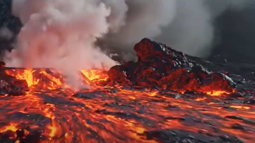
The rock is still warm. Not metaphorically, you can feel it through the soles of your boots. It is black, porous, almost weightless, and it crumbles at the edges if you press too hard. This particular stretch of ground near Reykjanes did not exist three years ago. It was ocean floor. Then it was magma. Now it is Iceland.
You are standing on something the planet just made. And that raises a question most visitors never stop to ask: if this rock is three years old, how old is the island beneath it?
The answer reframes everything you see here.
Deep Time Iceland: Earth’s History in 1 Day
The Earth is 4.5 billion years old. That number is too large to hold in the mind, so try this instead: compress the entire history of the planet into 24 hours.
Life appears around 4 in the morning. The first fish swim at about 9 in the evening. Dinosaurs rise at 10:40 pm and are gone by 11:40. The first modern humans appear at 11:58 and 48 seconds. Every civilization you have ever read about fits into the last two seconds before midnight.
Iceland? Iceland appears at 11:58.
At most geological scales, Iceland is not ancient. It is barely 16 to 20 million years old, which makes it one of the youngest landmasses on Earth. In the 24-hour model, it rises from the sea about the same time your ancestors were learning to walk upright. The lava that erupted near Reykjanes in 2024 belongs, in that same scale, to the last fraction of a second.
This is what geologists call deep time: the practice of measuring the world in millions of years and learning to feel, however briefly, what that actually means.
The Hotspot Beneath The Atlantic
Iceland exists because two things happened to coincide in the same place, at roughly the same time.
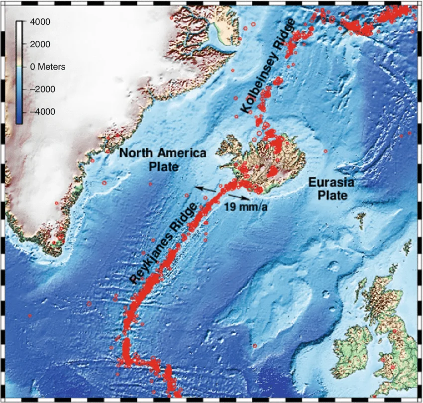
The first is the Mid-Atlantic Ridge, the underwater mountain chain that runs the length of the Atlantic Ocean. Two tectonic plates, the North American and the Eurasian, are slowly pulling apart here, at about two centimetres per year. Where they separate, magma rises to fill the gap. The entire ocean floor is, in a sense, built from this process.
The second is a hotspot: a fixed column of unusually hot mantle material rising from deep inside the Earth. Think of it as a blowtorch aimed at the underside of the moving plates. The plates drift over it. The hotspot stays put. Wherever the two align, material accumulates, piles up, and eventually breaks the surface.
Iceland sits directly above that hotspot, right at the ridge. Both processes are working simultaneously. This is why it is the only place on Earth where the Mid-Atlantic Ridge is visible above sea level, and why the island is so much larger and thicker than the ocean floor around it.
| The science in brief : Mid-Atlantic Ridge, the boundary where two tectonic plates pull apart, producing new ocean floor. Hotspot, a plume of hot mantle material that punches through the plate above it, independent of plate boundaries. Iceland sits on both, which is why it produces far more volcanic material than a typical ridge segment. Source: Iceland GeoSurvey (ÍSOR) and the Geological Society of America. |
Deep Time Iceland: 16 Million Years of Growth
Around 60 million years ago, the North Atlantic hotspot began punching through the seafloor with unusual intensity. The evidence is still visible today in the basalt plateaus of Greenland and northern Scotland , enormous outpourings of lava from a mantle that was, for reasons still debated, unusually active.
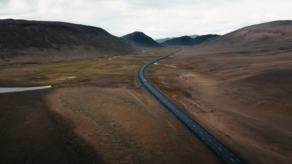
The first Icelandic landmasses appeared between 16 and 20 million years ago. They were not a single island but a series of volcanic ridges, separated by shallow seas, gradually building on themselves through successive eruptions. The island as a coherent landmass is younger still.
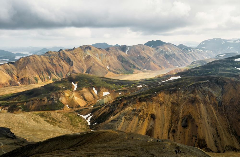
Then the ice ages arrived. Between roughly 2.5 million and 10,000 years ago, glaciers advanced and retreated across Iceland multiple times, carving the fjords, grinding the highlands flat, and pressing the land so far down that parts of it were below sea level. When the last ice retreated, the island slowly rebounded. It is still rebounding today, at a rate of several millimetres per year in some areas.
According to research published by the University of Iceland’s Institute of Earth Sciences, the eastern fjords contain some of the oldest exposed rock on the island, at around 16 million years, while the active volcanic zones in the southwest are geologically minutes old. Walk from east to west across Iceland and you are walking forward through geological time.
The Island Is Still Growing
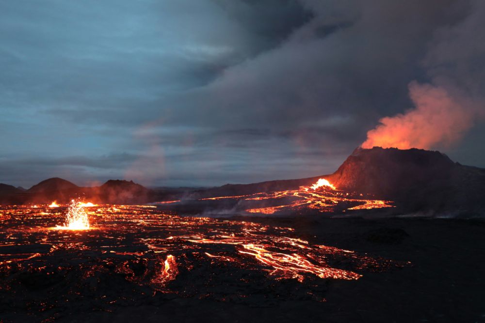
In November 2023, a fissure opened on the Reykjanes peninsula and poured lava across the road leading to Grindavik. It was not the first eruption in the area since 2021, and it will not be the last. Geologists believe the peninsula has entered a period of activity that could last decades, similar to cycles seen in the geological record roughly every 800 years.
Each eruption adds new land. Since 2021, several square kilometres of fresh lava have solidified on the surface of the peninsula. The island is measurably larger than it was four years ago.
The two-centimetre annual separation of the tectonic plates also means that Iceland is, very slowly, widening. Over one million years, that adds up to twenty kilometres. The rock you are standing on is moving away from the rock on the other side of the island, and new material is constantly filling the space between.
For more on what these eruptions look like up close, and what caused the awakening of Reykjanes after centuries of quiet, the full story is in What happened at Reykjanes?.
A Process, Not a Place
Most of the places we visit feel permanent. Mountains look like they have always been there. Coastlines seem fixed. Iceland refuses that illusion.
Here, the ground moves. Lava fields that smell of sulfur are still cooling. Earthquakes rattle windows in Reykjavik on ordinary Tuesday mornings. The island you are standing on is younger than many mountain ranges, younger than the Amazon rainforest in its current form, younger than most of the landscapes humans have ever called home.
What deep time asks of you is not to memorise dates. It asks you to look at a lava field and understand that you are not looking at scenery. You are looking at a verb. Iceland is not a place that formed. It is a place that is forming, and you happened to arrive during a particularly interesting sentence.
Continue reading
To understand the rocks that make up this young island: Basalt, obsidian and lava fields: how to read the rocks of Iceland.
To feel the tectonic forces in person: Standing on two continents: the Silfra rift and Iceland’s tectonic secret.
For the full picture of Iceland’s volcanic landscape: Iceland’s Volcanoes: A Beginner’s Guide.
Want to read the Earth everywhere you travel? Join the Geonatra newsletter — one story, once a week, from somewhere on the planet worth understanding.
Pingback: Iceland Volcanoes Explained ; The Guide to Earth's Fire
Pingback: Iceland Volcanic Rift: The Seam That Built Earth
Pingback: Iceland Highlands Geology: What the Colors Actually Mean
Pingback: Why Japan Has Earthquakes and Volcanoes: The Tectonic Truth