Most packing lists for Iceland answer the same question: how do you not get cold. This one answers a different question: how do you arrive prepared to understand what you are going to see.
The two lists overlap. You will need waterproof layers either way, and good boots regardless of your intentions. But once those basics are covered, the choices you make about what else to carry determine something more than comfort. They determine whether Iceland remains a series of impressive photographs or becomes a place you actually read.
An iceland packing list geology travelers use starts where most others stop. The gear that makes a volcanic landscape legible is not expensive or specialist. It is specific, and most of it fits in a jacket pocket.
Iceland Packing List: Observation Gear
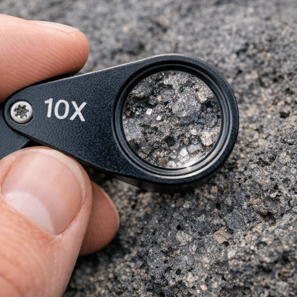
A 10x hand lens. Also called a loupe. It costs less than a meal in Reykjavik and transforms what you can observe at any rock surface. At Dettifoss, it shows you the crystal structure in basalt columns. At Snaefellsnes, it makes the difference between a lava tube wall and a flow-banded rhyolite readable. Most geological features in Iceland are large enough to see from a distance. The details that tell you how they formed require something closer.
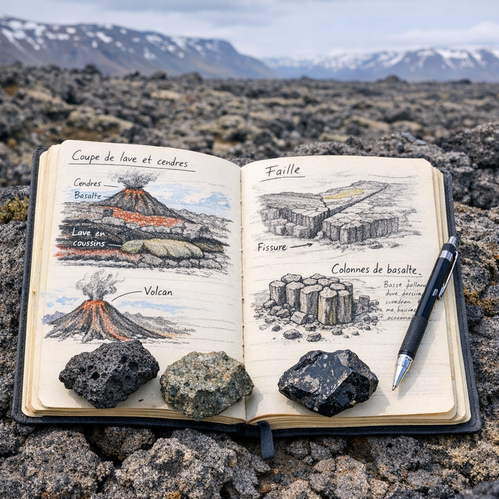
A waterproof field notebook. Not a phone notes app. Paper works when your hands are cold, when the screen glares in summer light, and when you want to sketch rather than photograph. A rough sketch of a rock outcrop forces observation in a way that a photograph does not. It asks you to make decisions about what is important, which is the first step in actually understanding something.
A geology identification app. Several apps now combine GPS with geological map overlays for Iceland specifically. They allow you to locate yourself within Iceland’s tectonic zones in real time and identify the rock formations around you. They are not a substitute for knowing something before you arrive, but they help connect what you see to the broader geological context of where you are standing.
For the larger context of how Iceland’s geological zones connect, the road trip planning guide maps out the five distinct geological worlds you will cross and what to look for in each one
Iceland Packing List: Mobility for Volcanic Terrain
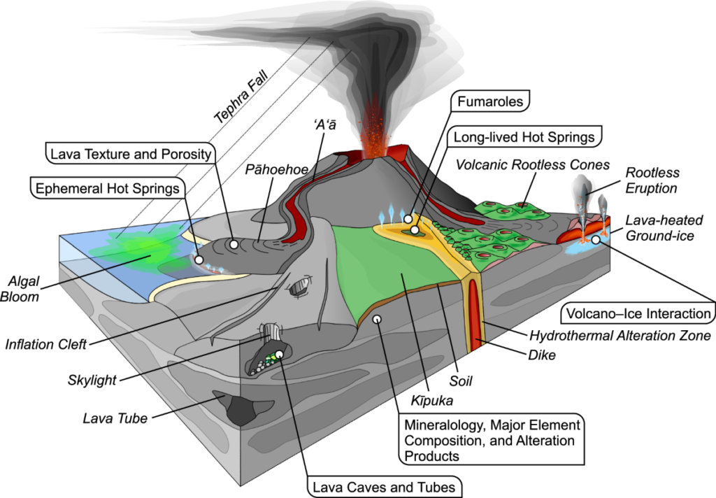
Waterproof boots with a rigid sole. Iceland’s lava fields are not uniformly smooth. Aa lava, the rough clinkery type that covers large parts of the interior and the Reykjanes Peninsula, is irregular and ankle-twisting underfoot. Pahoehoe lava surfaces are smoother but can be slick when wet. A rigid midsole protects your feet over long distances on uneven volcanic rock. Running shoes are not appropriate for anything beyond paved viewpoint areas.
Layered waterproof outerwear. Iceland’s weather changes faster than most travelers expect. A clear morning at Vatnajokull can become rain and wind within an hour. The layering system, a moisture-wicking base layer, an insulating mid-layer, and a waterproof shell, is not optional in Iceland. It is the standard operating condition.
Trekking poles. More useful than most people expect, particularly on the descent from elevated viewpoints, on river crossing approaches in the highlands, and on any surface that combines slope with loose volcanic gravel. They also help on Dettifoss‘s mist-covered approach paths, where the basalt stays permanently wet.
Crampons and glacier equipment are never on this list because they are always provided by certified glacier operators. Attempting a glacier independently without proper equipment is dangerous and discouraged by every relevant authority.
Knowledge: What to Read Before You Arrive
A field guide to Icelandic rocks. A physical reference you can carry is worth more than a screen-based alternative in conditions where your phone battery is cold and your hands are occupied. Several compact guides cover Iceland’s volcanic rock types with field identification photographs. The effort of identifying what you are looking at before reading an explanation is what makes the information stick.
A geological map of Iceland. The Icelandic Institute of Natural History publishes geological maps covering the entire island. Even a simplified version, understood before departure, changes the quality of observation at every stop. You will know whether you are on young basalt, older rhyolite, or glacial sediment, and that context shapes everything else you see.
The Iceland vs Hawaii comparison is also useful pre-trip reading: it frames Iceland’s geology against a reference point many travelers already know, which makes the specific features of the island easier to place.
Digital: Apps That Earn Their Place
The Veðurstofa Íslands app, produced by the Icelandic Meteorological Office, is the only weather and volcanic alert reference that matters in Iceland. It provides real-time seismic activity data, eruption alerts, road conditions, and weather forecasts with the accuracy that only a national meteorological service can offer. Checking it before any day in the field is not caution. It is the minimum requirement for traveling safely in an active volcanic country.
Offline maps. Signal in Iceland’s interior is unreliable and often completely absent. Download offline maps covering your entire route before leaving Reykjavik. The F-roads in the highlands do not appear on standard navigation apps with sufficient detail. Dedicated offline mapping applications with Iceland-specific data are a more reliable option.
Safe Travel Iceland. The official platform of the Icelandic Search and Rescue Association allows you to register your travel plan before entering remote areas. If you do not return when expected, it triggers a response. It is free and takes two minutes. In the highlands and on remote coastal routes, it is worth those two minutes.
Ethics: What Not to Bring and What Not to Do
Leave the geological hammer at home. Collecting rock samples from Iceland’s nature reserves and national parks is illegal without a scientific permit. This includes loose fragments, volcanic sand, obsidian pieces, and anything else from the ground. The law exists because geological sites are irreplaceable once disturbed, and because the cumulative effect of millions of visitors each taking a small piece is not small. Photograph what you find and leave it exactly where it is.
Avoid synthetic-coated gloves when touching formations. Some rock surfaces, particularly fine crystalline basalt and obsidian, retain oils and coatings from contact. If you are touching formations closely, bare hands or uncoated gloves preserve the surface more faithfully for the next person and for scientific purposes.
No open collection bags. Arriving with a container intended for specimens signals intentions that are both illegal and counterproductive to the experience itself. The point of reading a landscape is to understand it in context, not to remove it from that context.
The list is short. Most of it is things you might already own or can borrow. What takes time is not sourcing the equipment but making the decision to arrive prepared to understand something, rather than simply to see it.
Iceland rewards that preparation more than almost any other destination. The geology is visible, recent, and legible if you know what to look for. The road trip guide gives you the itinerary and the context. This list gives you what to put in the bag before you go.
For the closing piece of this dossier, see What Iceland Teaches Us About Our Own Planet.
Frequently Asked Questions
What gear do I need for a geology trip to Iceland?
The essentials are waterproof boots with a rigid sole, layered waterproof outerwear, and trekking poles for uneven volcanic terrain. For observation, a 10x hand lens and a waterproof field notebook cover most situations. The Veðurstofa Íslands app is essential for real-time weather and volcanic alerts. Everything else, crampons for glaciers, helmets for lava tubes, is provided by certified operators.
Are there apps that help identify rocks in Iceland?
Several geology apps combine GPS positioning with Icelandic geological map overlays, allowing you to identify the rock formations around you in real time. The Veðurstofa Íslands app, from the official Icelandic Meteorological Office, is the essential safety and conditions reference. For offline navigation, download dedicated hiking maps before leaving Reykjavik as signal in the highlands and remote areas is unreliable.
Is it legal to collect rocks in Iceland?
No. Collecting rocks, minerals, fossils, or volcanic material from Iceland’s nature reserves and national parks is illegal without a scientific permit. This applies to loose fragments, volcanic sand, and obsidian as well as larger specimens. Outside protected areas, collection is technically permitted but widely discouraged because the cumulative impact of millions of visitors taking material is significant and irreversible. The legal and ethical answer is the same: photograph it and leave it.