
A Buried Ocean You Can Walk On
About 800 kilometers south of Marrakech, in a dust-blasted valley near the town of Bou Azzer, you can walk across the floor of an ocean that no longer exists. The water vanished 660 million years ago. What remains is the rock that once lay beneath it: pillow basalts, serpentinites, gabbros, all the diagnostic ingredients of oceanic crust, twisted by tectonic collision and shoved up onto the African continent.
Geologists call this kind of rock an ophiolite. It is one of Earth’s strangest gifts: a fragment of ancient ocean preserved on dry land. Bou Azzer is one of the oldest and best preserved ophiolites in Africa, and it sits in the heart of a mountain range that very few travelers have heard of: the Anti-Atlas.
Most visitors to Morocco assume the Atlas Mountains are the country’s geological spine. They are not. The Atlas is geologically young, a teenager pushed up in the last 80 million years. South of it lies the Anti-Atlas, a different story altogether. Its rocks formed before life had even crawled onto land. Its mountains were already old when the first dinosaurs walked. And buried inside it, like a lost city in the desert, sits the wreckage of a Pan-African ocean.
This is the second chapter of Morocco’s deep time story.
What Is the Anti-Atlas? (And Why It’s Not Just “South of the Atlas”)
The Anti-Atlas is a roughly 500-kilometer-long mountain belt that stretches from the Atlantic coast near Agadir to the edge of the Sahara near Tafilalt. It runs parallel to the High Atlas but lies south of it, separated by the Souss Basin. From a map, the two ranges look like siblings. From a geologist’s perspective, they are nothing alike.
The High Atlas is recent. It started rising around 80 million years ago when Africa began squeezing against Europe, and it is still rising today. Most of its rocks were laid down in the Mesozoic, when this part of Africa lay underwater. Visit any High Atlas valley and you will find limestones full of marine fossils.
The Anti-Atlas is something else entirely. Its core is built of Precambrian rocks, some Paleoproterozoic (around 2 billion years old), most Neoproterozoic (800 to 540 million years old). It was first uplifted as a mountain range during the Pan-African orogeny, ending around 580 million years ago. It was then eroded flat over hundreds of millions of years, buried under sedimentary cover, and finally reactivated during the Variscan orogeny around 330 million years ago when Africa collided with the rest of Pangea. The Atlas uplift of the Cenozoic gave it a final boost.
What we see today is a stack of geological epochs: an ancient Precambrian basement at the bottom, punctuated by five “windows” (called boutonnières in French) where the deep rocks pierce through the younger Paleozoic cover. These windows are where the real story of the Anti-Atlas is told.
Bou Azzer: An Ocean Frozen in Time
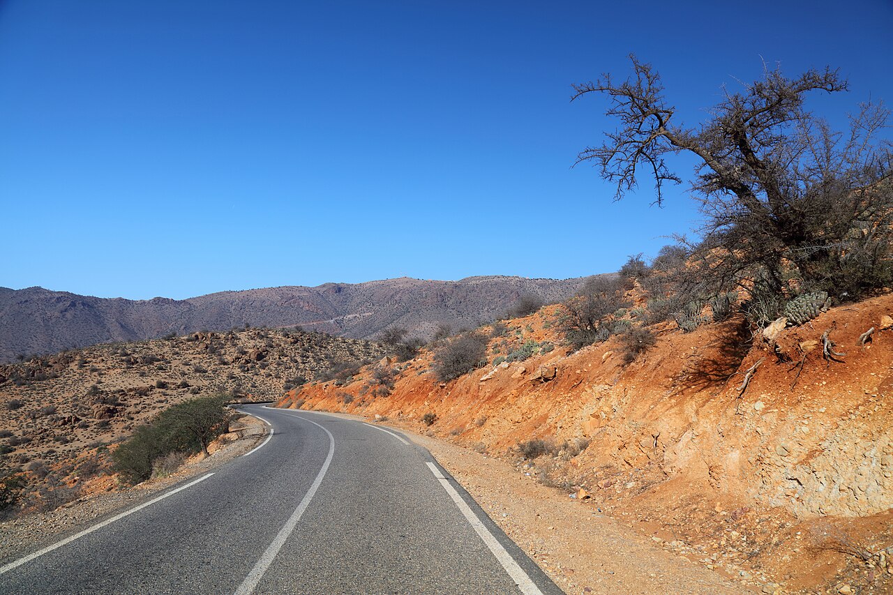
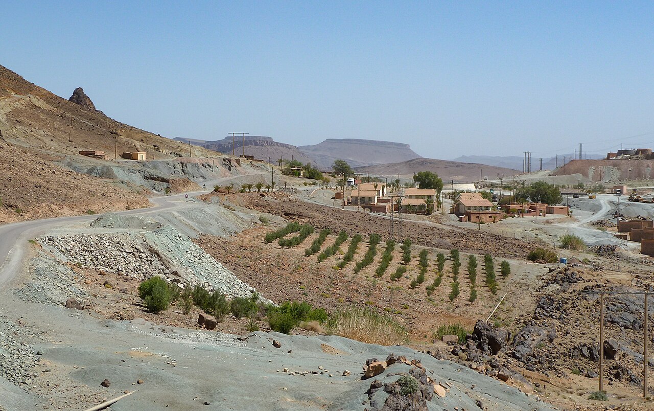
Roughly halfway between Ouarzazate and Zagora, the road southwest of Agdz crosses a region of dark weathered hills, dusty mining tracks and the occasional cobalt extraction site. This is the Bou Azzer-El Graara boutonnière, one of the most studied geological windows on the African continent.
The reason geologists pay so much attention to Bou Azzer is simple. Buried in its bedrock lies a complete ophiolite sequence: an intact slice of ancient oceanic crust. Most oceanic crust on Earth gets recycled back into the mantle at subduction zones, so it never survives long enough to be studied. Ophiolites form when a small piece of oceanic crust gets pushed up onto a continent during a collision, escaping the subduction conveyor belt. Bou Azzer is one of the best examples in Africa, and one of the oldest known anywhere on Earth.
The ophiolite at Bou Azzer and its sister outcrop at Aït Ahmane preserves nearly all the layers you would expect in a piece of ocean floor: serpentinized peridotites at the base (the upper mantle), layered gabbros above (slow-cooled magma chambers), basaltic dykes (the feeder pipes that brought magma up), and pillow basalts at the top (lava chilled rapidly under seawater). The orthogneisses and metagabbros of the Tazegzawt and Bou Azzer massifs have been precisely dated using uranium-lead zircon methods, returning ages of 753, 752, and 745 million years. Subsequent leucogranodiorite intrusions, which cut through the older complex, give ages between 705 and 695 million years.
Translation: this rock represents the floor of an ocean that opened in the Neoproterozoic, peaked around 760 million years ago, and finally closed roughly 100 million years later. We are looking at the very last evidence of a body of water that vanished long before fish, before insects, before any land plant.
There is one more reason Bou Azzer matters. The serpentinites of the ophiolite host a globally rare mineral deposit: cobalt arsenide ores. The Bou Azzer mine, operated continuously since the 1930s by Managem, is one of the world’s primary sources of cobalt extracted as a main product (most cobalt globally is a by-product of nickel or copper mining). The element that powers your phone battery is mined out of an ancient sea floor in the Moroccan desert.
The Pan-African Story: Building a Mountain Range Older Than Animals
The story Bou Azzer tells fits into a much larger framework. Between about 800 and 540 million years ago, the supercontinent Rodinia was breaking apart and a new supercontinent, Gondwana, was being assembled. The collisions that built Gondwana are called the Pan-African orogeny, and they left their mark across Africa, South America, India, Madagascar and Antarctica.
In what is now Morocco, the Pan-African orogeny followed a recognizable sequence. Around 800 to 780 million years ago, the northern edge of the West African Craton (see Chapter 1 of this series) started to stretch. An ocean basin opened. Volcanic island arcs developed on its rim, dated between 770 and 760 million years ago. By around 750 million years ago the ocean had developed full oceanic crust, the very rocks now preserved at Bou Azzer.
Then the direction reversed. Around 700 million years ago, subduction began consuming the ocean floor. Granodiorite intrusions of this age cut through the older ophiolite, marking the new arc magmatism. Over the next 100 million years, the ocean closed. The continental blocks on either side collided. Around 660 to 580 million years ago, the ophiolite was scraped off the descending slab and shoved onto the West African Craton in a process geologists call obduction. Diorite intrusions of 654, 653 and 641 million years mark the syn-collisional and post-collisional magmatism.
By the end of the Neoproterozoic, the Anti-Atlas was a Pan-African mountain range. It was high. It looked, presumably, something like the modern Alps. There were no animals to see it. The only life on Earth was microbial.
The molasse deposits filling the Trifya Basin, the very last sediments shed off this dying mountain range, mark the end of the orogeny. They are overlain by the Ouarzazate Group, dated around 566 million years ago, a thick package of pyroclastic flows that represents the post-collisional collapse and extension of the new mountain belt. Then the Adoudounian platform sediments, around 540 million years ago, mark the beginning of a long peaceful chapter: the Cambrian sea spreads over an eroded, low-lying Anti-Atlas.
The Five Windows: Touring the Anti-Atlas Boutonnières
Today’s Anti-Atlas owes its visibility to five distinct windows where Precambrian basement crops out from under the younger Paleozoic cover. Each window tells a different chapter of the story.
Kerdous (Western Anti-Atlas, near Tafraoute): The Kerdous boutonnière exposes the oldest rocks in the Anti-Atlas after the West African Craton itself. Its core is Paleoproterozoic, around 2 billion years old, part of the so-called Eburnean orogeny. Over the Eburnean basement sits Pan-African cover, including the iconic pink Tafraout granite, emplaced around 580 million years ago during the late stages of the Pan-African collision. Today, Tafraout’s rounded granite domes are one of Morocco’s most photographed landscapes.
Bas Draa and Ifni (Southwestern Anti-Atlas): Smaller boutonnières exposing late Neoproterozoic granitoids and the metamorphic remnants of the Pan-African belt. The Ifni granite, dated to about 660 million years ago, was emplaced during the syn-collisional phase of the orogeny.
Bou Azzer-El Graara (Central Anti-Atlas): The star, described above. The boutonnière sits directly on the Anti-Atlas Major Accident (AMAA), the Pan-African suture itself. Walk across this line and you walk from the cratonic domain (ancient and stable) to the Pan-African domain (built by collision).
Saghro (Eastern Anti-Atlas): The Saghro mountains expose Neoproterozoic volcanic and plutonic rocks, mostly between 615 and 555 million years old. The region is rugged, sparsely populated, and crossed by ancient transhumance trails still used by Berber shepherds. Trekking the Saghro is one of Morocco’s most authentic geological hiking experiences.
Siroua (between High Atlas and Anti-Atlas): Technically the Siroua is part of the Anti-Atlas system but it also hosts a much younger feature: a large Pliocene-Quaternary volcanic complex sitting on top of the older basement. The Pan-African Tachakoucht ophiolite, dated to 761 million years, is preserved here, making Siroua a geological hinge point between the Anti-Atlas and the Atlas.
Then Africa Crashed Into Pangea: The Variscan Reactivation
By the early Paleozoic, the Anti-Atlas had been eroded almost flat. Cambrian and Ordovician seas covered it in sandstones, shales and limestones. The mountains were gone. The roots remained.
Then, around 330 million years ago, everything changed. Africa, drifting north as part of Gondwana, collided with Laurussia (the precursor of Europe and North America) to form the supercontinent Pangea. The collision pulse, called the Variscan orogeny, did not build a new mountain range in the Anti-Atlas region. Instead, it reactivated the old Pan-African scars.
The Anti-Atlas Major Accident, the deep suture buried under the Bou Azzer boutonnière, slipped again. This time it pushed the Paleozoic sedimentary cover into a series of folds and thrusts. The spectacular folds you see today in the Ordovician sandstones of the Bani range, the Devonian Rich formations near Tata, and the imbricated structures of the Tagragra of Tata are all Variscan, not Pan-African. The basement underneath barely moved. The cover took all the deformation.
This is one of the things that makes the Anti-Atlas geologically unusual: it preserves two mountain-building episodes separated by 250 million years. The Pan-African mountains built the basement. The Variscan reactivation deformed the cover. The Atlas uplift of the last 80 million years gave us the relief we see today.
How to Visit: A Geotourist’s Anti-Atlas Itinerary
Unlike Chapter 1’s Reguibat Shield, the Anti-Atlas is fully open to travelers. No special permits, no military authorization. You can drive every road we describe with a standard rental car, with some piste sections requiring a 4WD.
Bou Azzer. The boutonnière is reached from Agdz (about 95 kilometers northwest of Zagora). Take the piste from Tagourt north toward Bou Azzer-El Graara through the Bou Tious valley. The mine itself is a working facility operated by Managem and is not generally open to casual visitors, but the surrounding outcrops of the ophiolite are freely accessible. A local guide from Agdz or Zagora is highly recommended. Plan a full day from your base.
Tafraoute and the Kerdous. Tafraout is a charming small town in the Western Anti-Atlas, three hours by road from Agadir. The Pan-African granites of the Tafraout massif surround the town in pink-grey domes and rounded outcrops. The road from Tafraout to Tiznit crosses the boutonnière at the Col du Kerdous, offering one of Morocco’s classic panoramic geological views.
Saghro. The Jebel Saghro is reached from Nkob or Boumalne-Dades. Multi-day treks with local Berber guides cross the volcanic Precambrian terrain. This is the place to come if you want to walk on rock that is 580 million years old without seeing a soul for hours.
Best season. October through April. Summer brings temperatures above 40 degrees Celsius and the boutonnières become inhospitable. Spring is exceptional for wildflowers and clear geological exposures.
What to bring. Sturdy hiking boots, plenty of water, sun protection, a hat. The 1:100,000 geological maps of Tafraout, Igherm, Bou Azzer and Goulmime are sold by the Service Géologique du Maroc in Rabat. A handheld GPS is useful in the boutonnières where road signs are rare. As always: take photos, leave the rocks.
Where the Anti-Atlas Fits: Morocco’s Layered Deep Time
If the West African Craton is the foundation of Morocco, the Anti-Atlas is the first storey built upon it. The Pan-African orogeny welded fresh continental material onto the craton’s northern edge between 800 and 580 million years ago. The Bou Azzer ophiolite marks the seam. North of that line, the rocks are Pan-African. South, they belong to the craton.
Future chapters of this series will follow the story forward. The Mesetas record a later mountain-building event in the Variscan, between 350 and 250 million years ago. The Atlas Mountains themselves are recent, less than 80 million years old. The Rif marks where Africa is still colliding with Europe today.
Geonatra’s deep time exploration has now covered three of Earth’s main tectonic regimes. Iceland shows what happens when continents rift apart along a mid-ocean ridge. Japan shows subduction in action. The Anti-Atlas shows what happens when these processes complete: an ocean opens, fills with crust, then closes again, leaving behind a buried suture and a fossil mountain range. Morocco preserves a complete cycle that no other country shows so cleanly in one drive.
Frequently Asked Questions
What is the Bou Azzer ophiolite?
The Bou Azzer ophiolite is a slice of ancient oceanic crust preserved in southern Morocco. It represents the floor of a Neoproterozoic ocean that opened around 800 million years ago and closed by 660 million years ago. The rocks include serpentinites, gabbros, basaltic dykes and pillow basalts, all the diagnostic layers of an ocean floor. It is one of the oldest and best preserved ophiolites in Africa.
How old are the rocks of the Anti-Atlas?
The oldest rocks in the Anti-Atlas are Paleoproterozoic, roughly 2 billion years old, exposed in the Kerdous boutonnière. The bulk of the Precambrian basement is Neoproterozoic, between 800 and 540 million years old. The sedimentary cover ranges from Cambrian (around 540 million years old) to Carboniferous (around 320 million years old).
Is the Anti-Atlas older than the Atlas Mountains?
Yes, by a wide margin. The Anti-Atlas basement formed during the Pan-African orogeny, ending around 580 million years ago. The Atlas Mountains began rising only in the late Cretaceous, about 80 million years ago. The two mountain belts share a name and a country, but they are products of completely different geological events.
What is a boutonnière in geology?
A boutonnière (literally “buttonhole” in French) is a geological window where ancient basement rock crops out through the cover of younger sediments. The Anti-Atlas has five major boutonnières: Kerdous, Bas Draa, Ifni, Bou Azzer and Saghro. Each one offers a window into a different stage of the Pan-African orogeny.
Can tourists visit Bou Azzer?
Yes. The Bou Azzer-El Graara boutonnière is freely accessible by road from Agdz or Zagora, with no special permits required. The active cobalt mine itself is not open to casual visitors, but the surrounding ophiolite outcrops are. A local geological guide from Agdz is recommended for the first visit.
Where can I see Pan-African rocks in Morocco?
The five Anti-Atlas boutonnières are the main exposures: Kerdous near Tafraoute, Bas Draa and Ifni in the southwest, Bou Azzer in the centre, and Saghro in the east. The Siroua massif and parts of the Eastern Anti-Atlas also expose Pan-African rocks. The classic Pan-African suture is found at Bou Azzer-Aït Ahmane.
Sources & Citations
- Soulaimani, A., Ouanaimi, H. (2011). Anti-Atlas and High Atlas, Western Loop / Central Anti-Atlas. Nouveaux Guides Géologiques et Miniers du Maroc, Volume 3. Notes et Mémoires du Service Géologique du Maroc, n° 558.
- Rjimati, E., Michard, A., Saddiqi, O. (2011). Western Anti-Atlas and Saharan Provinces. Volume 6, Notes et Mémoires du Service Géologique du Maroc, n° 561.
- Leblanc, M. (1975). Ophiolites précambriennes et gîtes arséniés de Cobalt (Bou Azzer, Maroc). Notes et Mémoires du Service Géologique du Maroc, n° 280.
- D’Lemos, R. S., Inglis, J. D., Samson, S. D. (2006). U-Pb zircon geochronology of late Neoproterozoic granitoids of the Anti-Atlas, Morocco. Precambrian Research.
- Inglis, J. D., Samson, S. D., D’Lemos, R. S., Hefferan, K. P., Admou, H., Saïd, A. (2004). U-Pb zircon geochronology of the late Neoproterozoic Bou Azzer-El Graara inlier, Morocco. Journal of African Earth Sciences.
- Hefferan, K. P., Admou, H., Hilal, R., Saquaque, A., Karson, J. A. (2002). Anti-Atlas Pan-African orogenesis. Precambrian Research.
- Ennih, N., Liégeois, J. P. (2008). The boundaries of the West African Craton, with special reference to the basement of the Moroccan metacratonic Anti-Atlas belt. Geological Society of London Special Publications.
- ONHYM (Office National des Hydrocarbures et des Mines), Morocco.
- UNESCO Global Geoparks Network, including M’Goun Geopark (Morocco).