
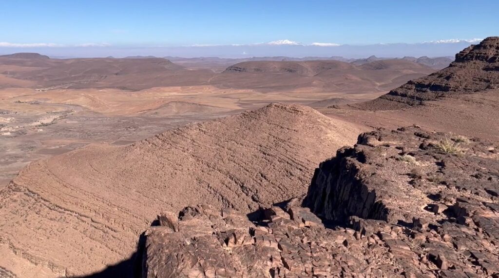
The Anti-Atlas is not really a mountain range. It is an open-air manual of Earth’s history, written in granite, schist, ophiolite, and the rare red dust that only forms where 3 billion years of geology meet North African sun. This overview connects every chapter of that story, from the Archean basement to the cobalt mines of today.
If you’ve read our pieces on the West African Craton and the Bou Azzer ophiolite, you have the foundations. This article is the master map that holds them together, and points to everything still to come in this cluster.
Anti-Atlas Geology in Brief
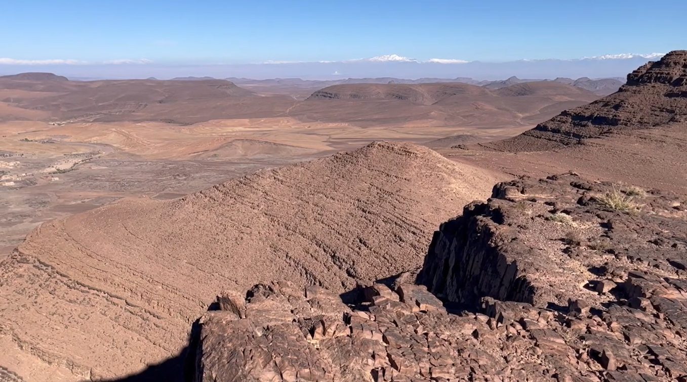
Anti-Atlas geology records the longest continuous geological story preserved anywhere on the African continent. The basement under your feet is between 2 and 3 billion years old. The granite domes you can touch are 660 million years old, formed during the Pan-African collision that built the supercontinent Gondwana. The Quaternary dunes of the southern foothills are barely 10,000 years old. The Anti-Atlas is, in one walking distance, almost the full geological column.
The chain stretches 700 kilometres from Agadir on the Atlantic to the Tafilalt oasis in the east. It separates the High Atlas to the north from the Sahara to the south. Politically it is in Morocco. Geologically it predates Morocco, Africa and the Atlantic Ocean themselves.
A Chain Whose Roots Reach 3 Billion Years
Most mountain belts have a beginning and an end. The Alps started 30 million years ago and are still growing. The Himalayas started 50 million years ago. The Atlas Mountains, just to the north of the Anti-Atlas, started around 80 million years ago. By those standards, the Anti-Atlas is unfathomably old.
Its oldest rocks belong to the Reguibat Shield, a fragment of Archean continental crust that crystallised between 3.0 and 2.0 billion years ago. At that time, the Earth had no multicellular life, no oxygen-rich atmosphere, and no plate tectonics in the form we know today. What is now the Anti-Atlas was simply a piece of an older, smaller continent drifting through a violently young planet.
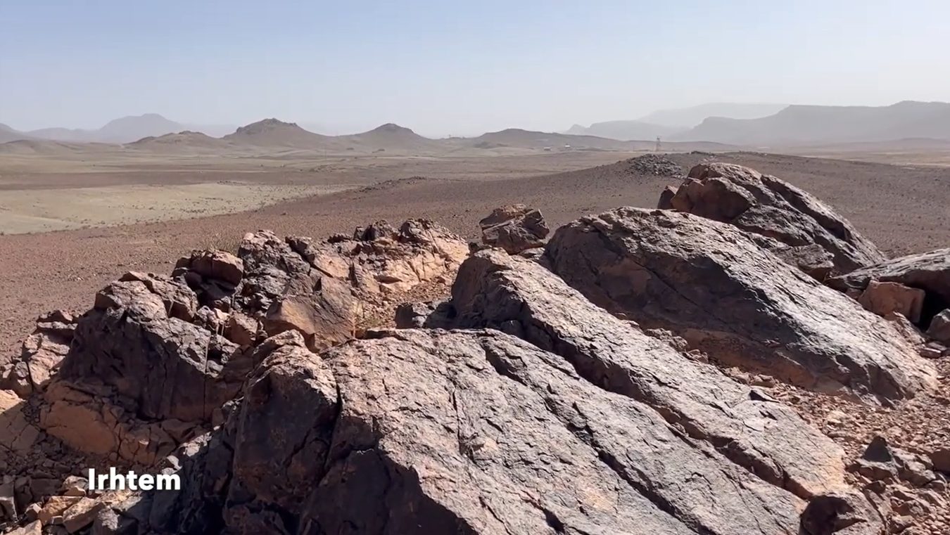
That basement still exists. You can walk on it in the deep south of the Anti-Atlas, near Akka, near Tata, in the Reguibat Shield exposures along the Saharan margin. It is the foundation upon which everything else has been laid down. Anti-Atlas geology, in a sense, begins here — at the absolute beginning.
The West African Craton: Morocco’s Foundation Stone
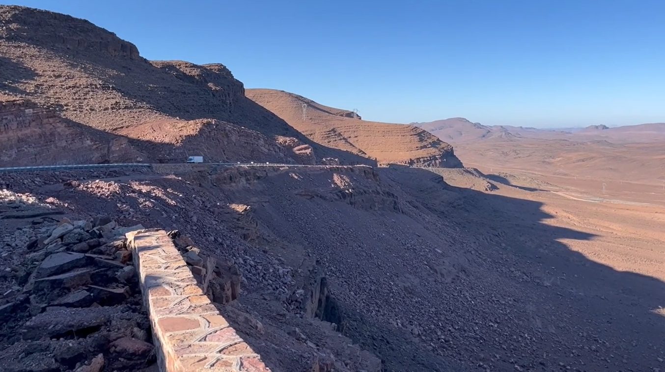
The Archean basement we just described is part of a larger entity: the West African Craton. A craton, in geology, is a stable continental nucleus that has not been deformed by major tectonic activity for billions of years. There are only a handful in the world. The West African Craton is one of them, and the Anti-Atlas sits at its northern edge.
Beneath the southern Anti-Atlas, beneath the desert plateau approaching the Sahara, the West African Craton extends down to depths of more than 200 km. That cratonic root is what allowed the Anti-Atlas to survive intact while younger ranges around it were folded, faulted, and eroded. The craton is the reason the Anti-Atlas exists at all.
We dedicated an entire pillar to this story: 3 Billion Years Below the Sahara: Inside Morocco’s West African Craton. If you want the craton’s full biography, read it.
The Pan-African Orogeny: When Continents Collided
Around 660 million years ago, the stable craton received an unexpected guest: another continent. The collision is now called the Pan-African Orogeny, and it is what gave the Anti-Atlas its modern structure.
Before the collision, an ocean separated the Reguibat Shield from the Hoggar Shield (now in Algeria). This ancient ocean is called the Pharusian Ocean. It closed slowly, like an enormous geological zipper, from south to north, between 750 and 600 million years ago. The closing produced subduction zones, volcanic arcs, and eventually a continental collision.
The clearest scar of that closing ocean is the Bou Azzer ophiolite: a 660-million-year-old slice of oceanic crust thrust onto the continent. It is one of the only well-preserved Neoproterozoic ophiolites in the world. We covered it in detail in Bou Azzer: A Lost Ocean Buried in Morocco’s Anti-Atlas Mountains.
The Pan-African Orogeny is also what created the famous granite domes of Tafraoute, the painted boulders of Aguard Oudad, and the deep schist valleys around Ameln. It was, in short, the formative event that turned a sleepy continental margin into the Anti-Atlas.
The 5 Geological Provinces of the Anti-Atlas
The Anti-Atlas is not uniform. Geologists divide it into five provinces, each with its own personality:
- Western Anti-Atlas — From Agadir to Bou Azzer. Granite domes, ophiolites, deep Precambrian outcrops. The classic landscape of Tafraoute and Aguard Oudad.
- Central Anti-Atlas — Around Akka and Tata. The southern frontier of the chain, where the Anti-Atlas merges into the Saharan plateau. The basement is at its oldest here.
- Eastern Anti-Atlas — Around Erfoud and Rissani. Famous for the Devonian fossils that fuel an entire local economy. Trilobites, ammonites, orthoceras — the Tafilalt is the world’s fossil capital.
- Saghro Massif — The volcanic eastern edge. Pan-African volcanic cones, black basalt, deep red sediment. Home to the Ait Atta Berbers and the last stand against the French in the 1930s.
- Siroua Massif — A 3,300 m volcanic plateau where the Anti-Atlas meets the High Atlas. The youngest volcanism in the entire chain (less than 10 million years old).
Each of these provinces deserves its own article, and they are coming. This master overview sits at the centre of the cluster; the dedicated pieces will be linked from here as they publish over the next two months.
Anti-Atlas Geosites You Can Walk
Anti-Atlas geology is not abstract. It is something you can touch, walk on, and read with your eyes. Here are the geosites that matter most:
- Tafraoute granite domes — 600-million-year-old granite, polished by the wind into curves you would not believe geology was capable of.
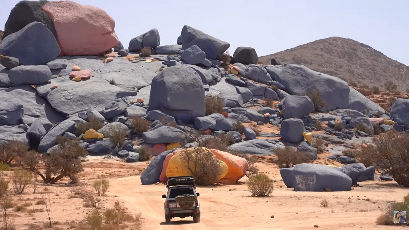
- Aguard Oudad (Painted Rocks) — The granite boulders painted blue by Belgian artist Jean Verame in 1984. The paint is fading. The granite is older than animals with backbones.
- Ameln Valley — 27 Berber villages built into the cliff face of an old erosional surface cut into the Pan-African basement.
- Adrar Mqorn — The 2,344 m summit above Tafraoute. From the top, you see the structure of the entire Western Anti-Atlas in one glance.
- Bou Azzer mines — The 660-million-year-old ophiolite. Active cobalt mining. The geology and the politics of the modern world meet here.
- Saghro lava cones — Black basalt and red sediment. The Pan-African volcanic record is preserved in textbook form.
- Tafilalt Devonian beds — Around Erfoud and Rissani. The famous fossil quarries. The Devonian Sea once covered all of this.
- Siroua summit — 3,300 m. The youngest volcanic activity in the Anti-Atlas. From the top, you can see both the Atlas to the north and the Sahara to the south.
- Jbel Bani — Twin Ordovician quartzite ridges near Zagora and Foum Zguid, the younger one hiding a rare Ice Age glacial record most travelers drive straight past.
The Economics of Stone: Fossils, Cobalt, Silver
Anti-Atlas geology is not just a story Geonatra writes about. It is the livelihood of tens of thousands of people who live along its outcrops. And that economic reality deserves attention.
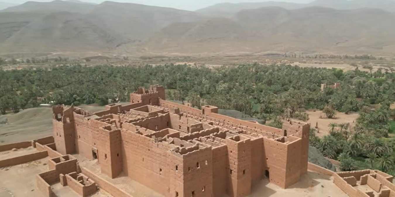
- Erfoud and Rissani sell fossils to the world. Trilobites are extracted from Devonian shales by hand, prepared by local artisans, and sold at workshops along the road. The trade is partly legal, partly grey, and increasingly polemical. We will return to it in a dedicated piece.
- Bou Azzer remains one of the only economically viable cobalt deposits outside the Democratic Republic of Congo. As the world’s electric vehicle industry scales, the geology of this small Anti-Atlas valley becomes geopolitically relevant.
- Imiter, just north of Ouarzazate, hosts Morocco’s largest silver mine. It has also been the site of the country’s longest social protest, the “Imiter Movement”, which since 2011 has occupied land near the mine to demand fair access to water and royalties.
The land beneath the Anti-Atlas is rich. The question of who benefits from that wealth is open. Geonatra plans to explore each of these stories in dedicated reports over the coming months.
Why the Anti-Atlas Deserves a Different Kind of Travel
Anti-Atlas geology rewards a slow approach. If you visit the Anti-Atlas the way you would visit Marrakech, you will miss everything. The roads are slower. The villages are quieter. The geology speaks at a different volume. You need time and a willingness to look at landscapes that do not announce themselves.
A road trip is the only sensible way to do it. Public transport is rare. Distances are long. The best stops are not on any standard tourist circuit. We wrote a complete 7-day Anti-Atlas road trip itinerary that connects the major geological sites with practical advice on the only thing that makes such a trip possible: a rental car.
Bring water. Bring patience. Bring a pen, because you will want to take notes on rocks you have never heard of.
What This Place Teaches
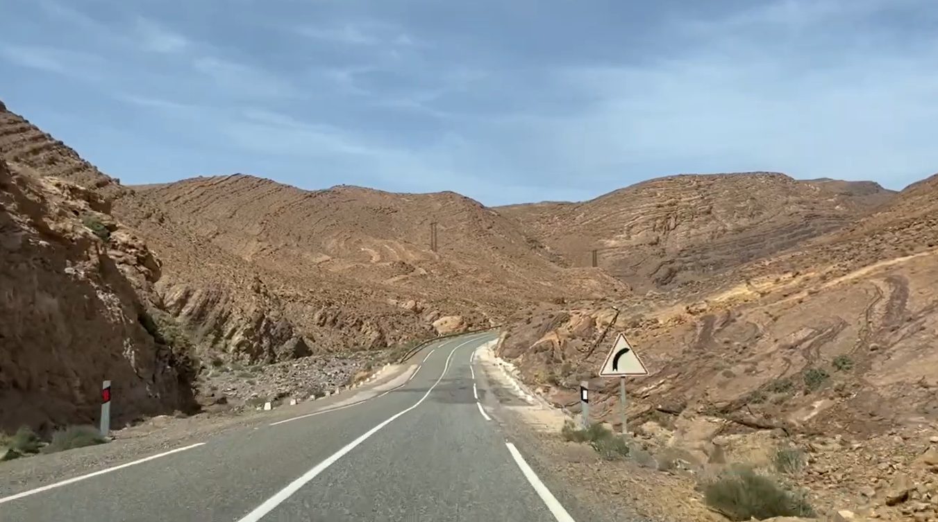
The Anti-Atlas teaches scale. Three billion years of geology is not a number we can really understand. But standing on a Reguibat granite outcrop, knowing that the rock under your feet existed before the first multicellular animals, before continents took their current shape, before any version of life resembling our own had appeared — that is a sensation that resets your sense of scale.
The Anti-Atlas also teaches patience. Mountains here have not changed shape in human time, but they are still slowly being eroded. The Sahara is, geologically, the eastern neighbour creeping further north. The whole chain is, in slow motion, being delivered piece by piece into the Atlantic by rivers that flow only when it rains.
Most of all, the Anti-Atlas teaches that geology and human history are the same conversation, just at different speeds. The Berber villages built into Ameln Valley sit on rocks that pre-date Berber identity by 600 million years. The cobalt powering electric vehicles in Tokyo was deposited in a 660-million-year-old ocean. The silver that funds the global jewellery industry is older than the Earth’s ability to support animal life.
The Anti-Atlas is, in this sense, the most honest geological school on Earth.
Frequently Asked Questions
How old are the rocks in the Anti-Atlas?
The oldest rocks belong to the Reguibat Shield and crystallised between 2 and 3 billion years ago. The Pan-African basement is around 750-600 million years old. The youngest rocks are Pliocene to Quaternary, less than 5 million years old. The Siroua volcanism is the youngest event, less than 10 million years.
What is the difference between the Anti-Atlas and the High Atlas?
The High Atlas is a young, Alpine-style mountain range (80 million years old, still actively uplifting). The Anti-Atlas is a much older, much more stable range built on cratonic basement, with its core dating back to the Pan-African Orogeny 660 million years ago. They are geologically separated by the South Atlas Fault.
Can I visit the Anti-Atlas without geological training?
Yes, and you will get more out of it than you expect. The Anti-Atlas is, by global standards, one of the most readable landscapes for a non-specialist. The rocks are exposed, the structures are visible, and the local economy still revolves around stone in a way that makes geology immediately tangible.
When is the best season to visit?
October to April. Summer is too hot in the southern Anti-Atlas (40°C+). Spring (March-April) brings almond blossoms in the Ameln Valley around Tafraoute. Autumn is dry and clear.
Is fossil collecting legal in the Anti-Atlas?
The legal framework is complex. Individual scientific collection by tourists is generally tolerated in small quantities. Commercial exploitation is regulated. Buying prepared specimens at workshops in Erfoud is legal. Removing fossils directly from protected outcrops without authorisation is not. We will return to this question in detail in our upcoming article on Erfoud’s fossil economy.
Bibliography and Further Reading
This article draws on field observations and on the official “Nouveaux Guides Géologiques et Miniers du Maroc” series, published in 2011 by the Service Géologique du Maroc as Notes & Mémoires N°556 to 564. Editors: A. Michard, O. Saddiqi, A. Chalouan, E. Rjimati & A. Mouttaqi. These nine volumes are the gold standard reference for Moroccan geology, written by more than 40 contributing scientists. They are bilingual French/English and freely consultable at the Direction du Développement Minier (Ministry of Energy and Mines, Rabat).
For further reading on the Pan-African Orogeny in North Africa, see Gasquet et al. (2008), The Pan-African Belt. The chapter is partially available on ResearchGate. For Moroccan geological resources, see the ONHYM (National Office of Hydrocarbons and Mines) and the Moroccan Ministry of Energy, Mines, Water and Environment.
About the Author
Daniel Harper is a geologist, educator and travel writer. He works between Iceland, Japan and Morocco, where he runs Geonatra, field guides that read landscapes like manuscripts. He learned to read the Anti-Atlas from some of the same authors cited above, who taught him directly in the field and in the classroom. Read his full bio.