
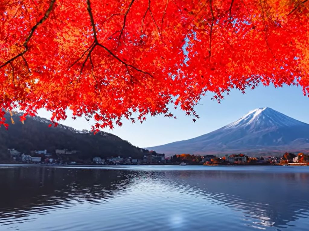
Japan sits at the intersection of four tectonic plates: the Pacific, Philippine Sea, Eurasian, and North American. This convergence produces roughly 1,500 earthquakes per year, 111 active volcanoes, and coastlines repeatedly reshaped by tsunamis. Japan did not settle despite these forces. It was formed by them, and its people have been answering their geological question for at least 16,000 years.
The ground moved at 3 a.m. Not violently. Just a low, slow shift, the kind that wakes you up without explaining itself. In Tokyo, this happens often enough that most people have learned to wait a few seconds before deciding whether to be concerned.
That pause is not indifference. It is the product of 16,000 years of geological education. Japan sits where four of the Earth’s largest tectonic plates push against each other, and its population of 125 million has learned, generation by generation, what that means. The word tsunami is Japanese. A people does not name a force that it has not spent centuries learning to read.
Japan tectonic plates geology is not background information about this country. It is the central fact of its existence. Understanding it changes how you read everything: the shape of the coastlines, the height of the mountains, the flexibility of the temple beams, the patience embedded in the culture.
Japan Tectonic Motion: 4 Plates, 1 Archipelago
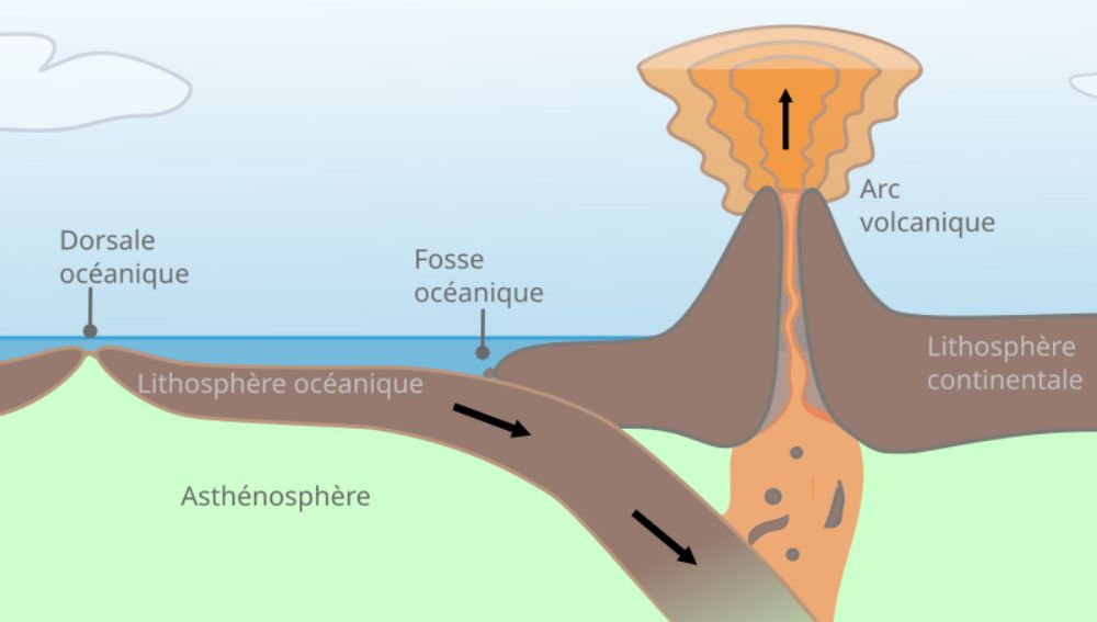
Most countries sit on a single tectonic plate, or straddle two. Japan sits at the junction of four. The Pacific Plate pushes westward and dives beneath the North American Plate along the Japan Trench, a gash in the ocean floor 10,500 metres deep running parallel to the country’s eastern coast. To the south, the Philippine Sea Plate subducts beneath the Eurasian Plate along the Nankai Trough. The Eurasian and North American plates press against each other across the interior of the country.
The result is a geological pressure system with no relief valve. Each plate moves slowly but without negotiation. The Pacific Plate alone travels westward at roughly 8 to 9 centimetres per year. When the stress accumulated at these boundaries releases, it does so suddenly, in events that last seconds but reshape geography for centuries.
Japan registers approximately 1,500 earthquakes every year. Most are too small to feel. But the system that produces them also produced the Great East Japan Earthquake of 2011, a magnitude 9.1 event that shifted the Earth’s axis by several centimetres and displaced the coast of Honshu by up to 2.4 metres to the east. The data is monitored continuously by the Japan Meteorological Agency, whose seismic network covers the entire archipelago in real time.
The Ring of Fire, the 40,000-kilometre arc of subduction zones encircling the Pacific Ocean, accounts for 90 percent of the world’s earthquakes and 75 percent of its active volcanoes. Japan occupies a central position within it, not at its edge but at one of its most complex intersections.
How an Archipelago Is Born from the Deep
Subduction is usually described as destruction: one plate forced beneath another, consumed by heat and pressure. That framing is accurate but incomplete. The same process that generates earthquakes also generates land.
As the Pacific Plate dives beneath the North American Plate, it carries water-rich oceanic crust into the mantle. The heat and pressure strip that water from the rock and inject it into the mantle above. Water lowers the melting point of rock. Mantle material that was solid begins to liquefy. The resulting magma, lighter than the surrounding rock, rises toward the surface. It accumulates in chambers. Eventually it erupts, adding material to the crust above.
Japan’s 111 active volcanoes are the direct expression of this process. Each one marks a point where subducting oceanic crust has been converted into magma and returned to the surface. Mount Fuji, at 3,776 metres the highest point in the archipelago and one of the most recognisable landforms on Earth, is a stratovolcano built by repeated eruptions over hundreds of thousands of years. Its perfectly symmetrical cone is the accumulated product of countless episodes of magma rising, cooling, and layering.
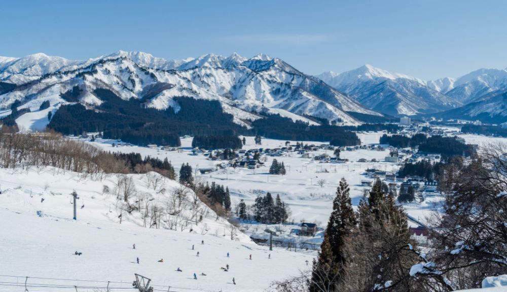
The Japanese Alps, which run through the centre of Honshu and reach peaks above 3,000 metres, were produced by the collision of plates rather than their separation. Where the Philippine Sea Plate meets the Eurasian Plate beneath central Japan, continental crust buckles upward. The mountains that result look like nothing a traveler would associate with volcanic geology, yet they are part of the same system.
The archipelago itself, that long curved chain of islands bending from Hokkaido in the north to the Ryukyu Islands in the south, follows the line of the subduction zones that created it. Its shape is not incidental. It is the surface expression of the geometry of the plates below.
The Question the Earth Has Been Asking for 15 Million Years
Japan in its current form is approximately 15 million years old. Before that, the islands were part of the Asian continent. The separation began when the Amurian tectonic microplate began to rotate, pulling land away from the continental margin and opening the Sea of Japan between them. The water filled the gap. The islands were cut off.
That separation is not a geological footnote. It determined everything. An isolated archipelago develops differently from continental land. Japan’s flora and fauna evolved in relative isolation. Its languages developed without sustained outside influence for millennia. Its culture, when it finally absorbed external elements from China and later from Europe, filtered them through the particular lens of a people shaped by insularity, by mountains that limit interior movement, by a coast that provides sustenance but also delivers destruction.
The word tsunami entered global scientific vocabulary from Japanese because no other major language had needed a specific term for the phenomenon as urgently as Japanese had. The 869 Jogan earthquake produced a tsunami that inundated the Sendai plain to a depth that would only be matched, thirteen centuries later, by the 2011 Tohoku event. Japanese sediment archives contain the record of both. The ground keeps its own account.
This is what deep time means in practice. Not an abstraction about millions of years, but the legible accumulation of geological events in the landscape, the language, the architecture, and the preparedness of the people who live inside it.
Japan Tectonic Motion: 1,500 Quakes a Year
The question that Japan’s geology poses is not rhetorical. It has a real answer, and that answer has been built, literally, into the fabric of the country.
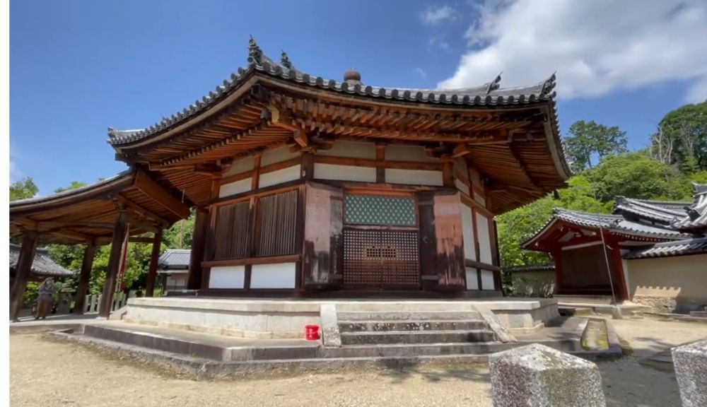
The oldest wooden structures in the world are in Japan. The Horyuji temple complex in Nara contains buildings constructed in the late 7th century, more than 1,300 years ago. They have survived dozens of major earthquakes. Their secret is structural: timber frames joined without nails, designed to flex rather than resist. The beams absorb seismic energy by moving with it. The buildings sway and return to vertical. The principle anticipated by centuries the engineering concept of base isolation that now underlies Japan’s modern skyscrapers.
Contemporary high-rise buildings in Tokyo and Osaka sit on shock-absorbing foundations that allow the structure above to move independently of the ground below. Some are equipped with tuned mass dampers, enormous weights suspended at the building’s upper floors that counteract the sway induced by seismic waves. These systems were not invented in response to earthquakes. They were refined by a culture that has never had the option of ignoring them.
Japan experiences roughly one significant earthquake every 73 hours. The country has developed an early warning system that can detect the initial, less destructive seismic wave and broadcast an alert before the more powerful secondary wave arrives. The gap is measured in seconds. But seconds, when the trains have stopped and the gas valves have closed, are enough.
This is resilience as geological response. Not defiance of the Earth’s forces but adaptation to their rhythms, across decades of engineering refinement and centuries of architectural intuition.
What Deep Time Looks Like from a Moving Island
Japan is still moving. The Ryukyu Islands are slowly migrating away from Kyushu as the Okinawa Trough widens beneath them. The Nankai Trough, where the Philippine Sea Plate subducts beneath the Eurasian Plate to the southwest of Honshu, accumulates stress in a cycle that has historically produced magnitude 8 or larger earthquakes roughly every 100 to 150 years. The last major Nankai event was in 1946. Seismologists consider the next one a matter of when, not if.
Mount Fuji has not erupted since 1707, when an eruption following the Hoei earthquake blanketed Edo, the city now called Tokyo, in ash. It remains classified as an active volcano under continuous monitoring. The magma system beneath it is intact. The question of its next eruption is geological, not statistical.
In Japanese aesthetics, the concept of mono no aware describes the melancholy of things that pass, the particular beauty of the ephemeral. Cherry blossoms are its most cited example: they are precious precisely because they last a week. There is a case to be made that this aesthetic did not emerge from philosophy alone. A culture that has lived for 16,000 years on ground that reshapes itself without warning may have developed, at a depth below conscious thought, a particular sensitivity to impermanence. The geology is in the culture.
At the scale of deep time, everything Japan has built is temporary. The islands themselves are temporary. The Pacific Plate will continue to subduct. The archipelago will continue to shift. In tens of millions of years, the geological forces that created Japan will have reconfigured it beyond recognition. What will remain, in the rock record, is the evidence of a place where four plates met, where magma rose to the surface, where a civilisation built in timber and steel learned to move with the ground rather than against it.
The civilizations that endure are not those that found stable ground. They are those that learned what to do with unstable ground. Japan’s answer to this problem is among the most elaborate ever constructed: a building tradition that absorbs earthquakes, a warning system that measures seconds, a sediment archive that remembers tsunamis from 1,000 years ago, and an aesthetic philosophy that finds beauty in the fact that nothing lasts.
Standing at the edge of the Japan Trench, or at the foot of Fuji, or in an old temple that has swayed through a dozen major earthquakes and returned to vertical, you are not looking at a landscape. You are reading a conversation between a geological process and the people it produced. That conversation has been going on for 15 million years. It is not finished.
Frequently Asked Questions
Why does Japan have so many earthquakes and volcanoes?
Japan sits at the intersection of four tectonic plates: the Pacific, Philippine Sea, Eurasian, and North American. Where two of these plates meet, one is forced beneath the other in a process called subduction. Subduction generates both earthquakes, as stress builds and releases, and volcanoes, as the subducting plate melts and magma rises to the surface. Japan’s position at multiple convergent boundaries means these processes occur simultaneously across the entire archipelago.
How was the Japanese archipelago formed geologically?
Japan formed through the subduction of the Pacific and Philippine Sea plates beneath the continental plates of East Asia. As oceanic crust was forced down into the mantle, magma rose to the surface and accumulated over millions of years, building volcanic islands. Around 15 million years ago, the Japanese islands separated from the Asian continent as the Sea of Japan opened. Their curved shape follows the geometry of the subduction zones that created them.
What is the Ring of Fire and why is Japan at its center?
The Ring of Fire is a 40,000-kilometre arc of subduction zones and volcanic systems encircling the Pacific Ocean. It accounts for 90 percent of the world’s earthquakes and 75 percent of its active volcanoes. Japan sits at one of the Ring’s most complex intersections, where four plates converge rather than two. This is why Japan experiences seismic and volcanic activity at a frequency and intensity that few other countries match.
What This Place Teaches
| The Geological LessonJapan is not a country that coexists with geological forces despite everything. It is a country shaped by them, at every level: its landforms, its architecture, its language, its aesthetics. Deep time is not something Japan contains. It is something Japan expresses. |
For Young Explorers
Find Japan on Google Earth. Zoom out until you can see the Pacific Ocean and the Asian continent together. Now locate the Japan Trench: it runs parallel to the east coast of Japan as a long, dark line in the ocean floor. This is where the Pacific Plate dives beneath Japan. Can you trace the line of volcanoes and islands that formed above it, from the Kuril Islands in the north all the way down to the Ryukyu Islands in the south?
The Deep Time Angle
Japan in its current form is 15 million years old. The oldest rocks on Earth are 4 billion years old. On that scale, Japan is younger than the grass on your lawn in geological terms. Yet in those 15 million years, it produced 111 active volcanoes, a 10,500-metre ocean trench, and a mountain range taller than the Alps. Subduction zones work fast.
Further Reading
The Japan Meteorological Agency publishes real-time seismic monitoring, volcanic activity alerts, and historical earthquake data for the entire archipelago. It is the primary scientific reference for Japan’s ongoing geological activity and the source used by researchers, emergency services, and engineers across the country.