
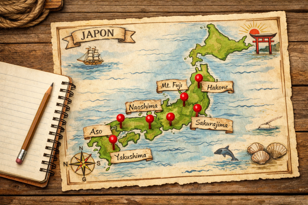
Japan’s most geologically significant places hide on six red pins, not on tourist maps. A paper map of Japan, pinned to the wall above a desk. Not the usual map. The temples are not marked. The restaurants are not marked. Even most of the cities are unmarked. Six red pins are pushed into the paper, scattered across Honshu, Kyushu and the Inland Sea.
Each pin marks a place where the ground does something almost nowhere else does. A perfect young volcano. An island of granite older than the surrounding country. A working caldera with a thousand years of inhabitants. A modern art island sitting on a ninety-million-year-old foundation. The largest inhabited caldera on Earth. A volcano that erupts almost daily, four kilometres from a city of six hundred thousand. The map is the article. Six places, six different ways the archipelago tells the story of itself.
Japan most geologically significant places: The Short Answer
Japan geological places that matter most: Mount Fuji for the textbook stratovolcano, Yakushima for granite older than the archipelago around it, Hakone for a caldera you can sleep inside, Naoshima for ninety-million-year-old basement rocks, Aso for the world’s largest inhabited caldera, and Sakurajima for a volcano in continuous daily activity.
What Makes a Place Geologically Significant
Geological significance is not the same as geological beauty. They often overlap, but they are not identical. A place is geologically significant when one of three conditions is met.
The first is legibility. A significant place is one where the underlying mechanism is visible at the surface, available to a careful eye without specialised equipment. A volcanic cone with layered eruption deposits is legible. A caldera with active fumaroles inside it is legible. A glacial valley with U-shaped cross-sections is legible. The geology speaks aloud, in a language the visitor can learn to read.
The second is singularity. A significant place expresses something rare or extreme on a global scale. The largest, the oldest, the most active, the only working example of a particular configuration. The point is not the superlative itself but what the superlative reveals about the underlying processes.
The third is depth of human relationship. A significant place is one where the geology has shaped, and continues to shape, the way people live nearby. The water in their tap, the food on their table, the building they sleep in, the news on their phone. The Earth is not background. It is part of the daily conversation.
Most places fail at least one of these three tests. The six places in this guide pass all three. They are the points where Japan reads itself out loud to anyone who learns the alphabet.
Mount Fuji: The Textbook Stratovolcano
Mount Fuji is the place every other Japanese volcano is measured against.
The shape is famously perfect: a near-symmetrical cone rising 3 776 metres from a flat foreland, with concave slopes and a small summit crater. The symmetry is not accidental. It is the product of youth (the present cone is roughly 100 000 years old, geologically very young), of regular eruption from a single central vent, and of a magma chemistry that produces relatively fluid andesite-to-basalt lavas. Most of the world’s most photogenic volcanoes share this combination, and Fuji is the cleanest example anyone can visit.
The photogenic geometry is only part of why Fuji matters. The mountain is also a working showcase of subduction-zone volcanism, the mechanism that built most of the Pacific ring. The lava layers visible at the fifth station, the lava tubes around Aokigahara, the lakes filling old eruption-dammed valleys, the Hoei Crater scar from the last major eruption in 1707, all read together as a textbook of how stratovolcanoes work in real time.
Fuji is also where Japan thinks of itself. The country has used the silhouette of a single volcano as its self-image for centuries, from Edo-period prints to the ten-thousand-yen note. The land and the imagination of the land are the same shape.
For travellers wanting to read it carefully, the seven geological stops on Mount Fuji walk through the layered eruption record one feature at a time. Visit it not as a mountain to climb but as a textbook to open.
Yakushima: Granite Older Than the Archipelago Itself
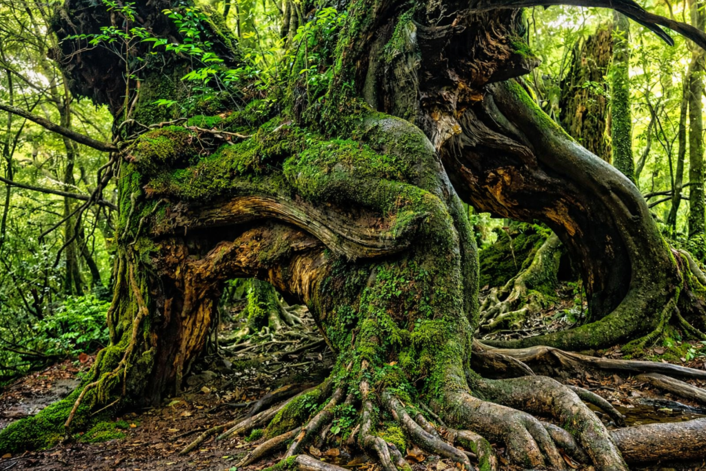
Yakushima sits roughly sixty kilometres south of Kyushu, a small mountainous island with a peak (Mount Miyanoura) reaching 1 936 metres. It is the wettest place in Japan, with the interior receiving over 8 000 millimetres of rain a year, feeding some of the oldest forests on the archipelago.
The geological surprise comes underneath. Most of the Japanese islands sit on rocks younger than 50 million years, the product of ongoing subduction and volcanic activity. Yakushima is different. The island is built around a granite pluton that crystallised roughly 14 million years ago at depth, was lifted and eroded by tectonic forces, and now stands exposed across most of the island.
That granite is the foundation of everything else on Yakushima. The famous Yakusugi cedars, including Jomon-sugi (estimated at 2 000 to 7 000 years old), grow directly on the granite, their roots gripping the rock through a thin layer of acidic soil. The waterfalls, the polished cobbles in the rivers, the smooth coastal cliffs are all granite features.
To understand Yakushima as a place, you have to step out of the rest of the Japanese archipelago for a moment. Most of the country is a young, restless construction. Yakushima is a quieter, older fragment, lifted unusually high above sea level. The full mechanism of how an island forest became seven thousand years old depends on this granite below. To put the timing in wider context, when these islands actually formed sits behind every step of the trail.
Hakone: Living Inside a Working Caldera
Hakone is the place Japan demonstrates that it is possible to live, comfortably and even routinely, inside an active volcano.
The caldera is roughly twelve kilometres across, formed by collapse around 230 000 years ago and modified by smaller eruptions since. Inside the ring, the lake of Ashi fills the southwest, the inner cone group of Kamiyama and Komagatake rises in the centre, and active fumaroles still vent at Owakudani. The Japan Meteorological Agency monitors the caldera continuously, and the alert level has stayed mostly at level 1 since records began.
The unusual feature is occupation. A hundred ryokan operate inside the caldera ring. The town of Hakone-Yumoto sits at the eastern entrance. The inner valley is criss-crossed by buses, trains, hiking trails and small shops. Children grow up in the caldera. Their grandparents grew up in the caldera. The Tokaido road has run through it since the Edo period, and the pattern of human occupation may go back to the Jomon.
What makes Hakone significant is not the geology alone but the thousand-year continuity of human life inside an active volcanic structure. To read the experience from the inside, what it means to sleep inside a volcano walks through a single ryokan stay as a guided tour of caldera chemistry.
Naoshima: Contemporary Art on 90-Million-Year-Old Granite
Naoshima is the only place on this list where the geology is essentially silent and the significance is what surrounds it.
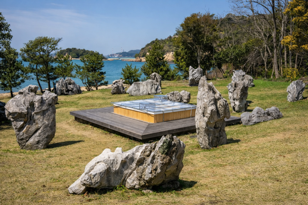
The island sits in the Seto Inland Sea, the long shallow body of water separating Honshu from Shikoku. Geologically, the Inland Sea region is a drowned granite landscape: the basement rocks are Cretaceous-age plutons (around 90 million years old), exposed by tectonic uplift and partial submergence over millions of years. Naoshima itself is a small bedrock outcrop, with the same granite running directly to its rocky shores.That ancient granite has become the foundation, in a literal sense, of one of the most concentrated contemporary art landscapes in Asia. Tadao Ando’s Chichu Art Museum is built into the granite itself, partially underground, with concrete walls poured against rock that was already old when the dinosaurs disappeared. The pumpkins of Yayoi Kusama sit on granite shorelines. The Benesse Art Site sits on Cretaceous bedrock.
Modern art rarely thinks about the rock under its feet. Naoshima is the rare place where contemporary art sitting on ninety-million-year-old granite is the thesis statement of the place itself.
Aso and Sakurajima: Two Active Volcanoes That Define Kyushu
Two volcanoes in Kyushu represent extremes of the Japanese arc, and together they form one entry on this map.
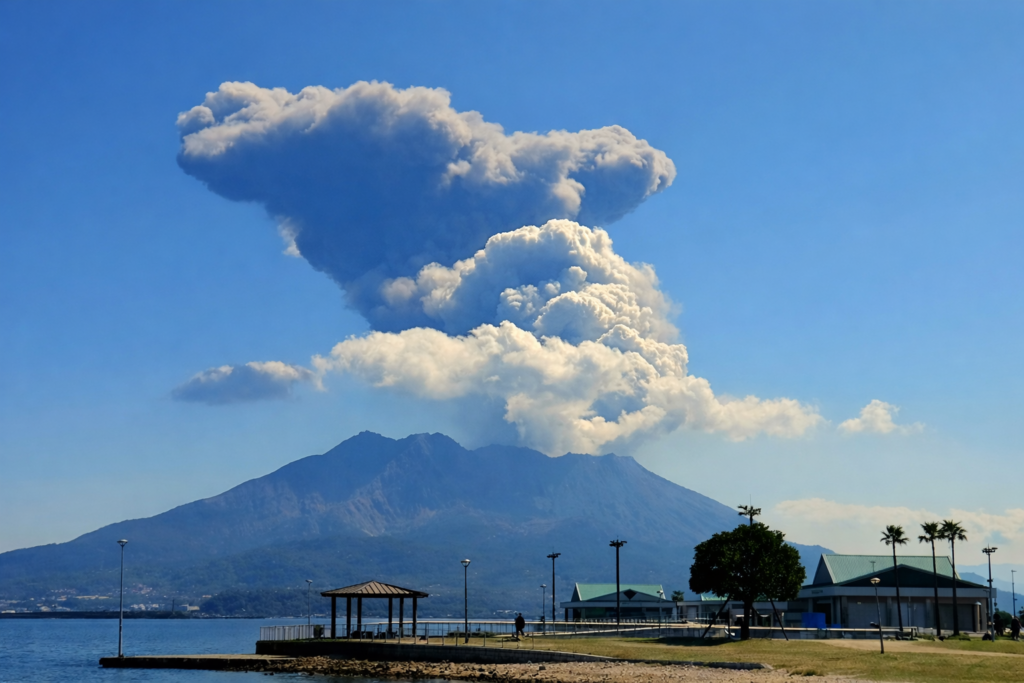
Aso is the largest inhabited caldera on Earth. The outer ring measures roughly 25 kilometres long and 18 wide, formed by four major pyroclastic super-eruptions between 270 000 and 90 000 years ago. The floor today supports about 50 000 permanent residents, including the towns of Aso-machi, Takamori and Minamioguni. Rice fields cover much of the lowland. The JR Hohi Line runs east to west across the floor. Akaushi cattle graze on volcanic plateau soils. At the centre, the Nakadake cone is intermittently active, monitored continuously by the Japan Meteorological Agency.Sakurajima is the opposite extreme. It is a single composite cone rising from the middle of Kagoshima Bay, less than four kilometres from the city of Kagoshima (population around 600 000). The volcano erupts on most days of the year, dusting the city in fine ash that residents sweep off their balconies as a routine of daily life. Schools have ash protocols. Cars sell with anti-ash windscreen wipers.
What makes the pair significant together is the contrast in human-volcano relationship. Aso shows what 27 000 years of accommodation looks like: a population that has woven itself into the geology over millennia. Sakurajima shows the daily-rhythm version: a city that wakes up under fresh ash every morning. The most volcanically active island in Japan is the larger frame around both.
How These Places Connect to Each Other
Read together, the six places form a small map of the different geological regimes of Japan.
Mount Fuji and Sakurajima are direct expressions of subduction-zone volcanism, with magma fed by the slabs descending under the Philippine Sea Plate or the Pacific Plate. Hakone and Aso are the same family, but written as collapsed calderas rather than standing cones. Yakushima represents the older basement, the rare exposed granite that pre-dates most of the modern arc. Naoshima represents an even older basement, the Cretaceous Inland Sea granite that runs through much of southwest Japan. The list is not exhaustive. Hokkaido’s Daisetsuzan, Okinawa’s coral platforms, Sado’s mining belt, the Izu Islands and Kamikōchi in the Japanese Alps could all have qualified. The six selected here pass all three significance tests with the most clarity.
For travellers wanting to read these places in continuous order on the ground, the practical route between these places lays out the fourteen-day version. For the wider tectonic frame, Japan’s place inside the Ring of Fire is the appropriate background reading.
Frequently Asked Questions
Why aren’t Tokyo or Kyoto on this list?
Tokyo and Kyoto are culturally significant Japanese places but not, in the strict sense used here, geologically significant. Tokyo sits on relatively recent sedimentary basins. Kyoto sits on a quiet granite-and-sediment basement. Both are remarkable cities, but the ground beneath them is doing nothing exceptional by Japanese standards.
Should I visit all six places in one trip?
Not necessarily. Two or three visited carefully will teach more than six rushed. A combination of Hakone, Fuji and Aso covers three of the four geological themes (active caldera, stratovolcano, super-caldera with population) in a single fortnight. Yakushima and Naoshima reward separate dedicated trips.
Are these places safe to visit given they’re often active?
Yes, with attention. The Japan Meteorological Agency monitors all of the volcanic sites in real time. Most public access points sit safely outside the active zones, and the monitoring system raises alert levels well before any visitor would be at risk. Always check the current alert level for any volcanic site before arriving.
What is the single most geologically significant place in Japan?
Different criteria yield different answers. By the test of legibility, Mount Fuji is hard to beat. By singularity, Aso wins. By depth of human relationship, Hakone or Sakurajima. The country is one of the few places on Earth where six different sites can each plausibly be the single most significant.
About the Author
Daniel writes for Geonatra from the field, reading landscapes the way others read libraries. He spent a season visiting all six of these places in sequence, sleeping in calderas and walking on ancient granite, with one quiet question in mind: what it means for a country to read itself out loud at six different addresses.