
The walk from Miyanoura port begins on stone. Wet granite slabs polished by years of rain and bare feet, climbing gently between low pines. A few hundred metres in, a Walter De Maria sphere appears in a darkened concrete chamber, and you forget for a moment that you are still standing on the hillside. Look up: art. Look down: the hill itself, older than almost anything around it.
Most travelers come to Naoshima for the museums. Tadao Ando’s Chichu, Yayoi Kusama’s spotted pumpkin on the pier, the Benesse House pavilions sitting along the shore. Few notice that the island under all of it is a single great mass of granite, far older than the country it belongs to. The art is the surface. The rock is the story.
Naoshima Granite Island: A Quick Overview
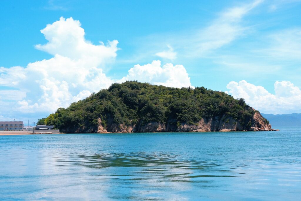
Naoshima is a small granite island in the Seto Inland Sea of western Japan, built from magma that cooled around ninety million years ago. The island’s gentle slopes and quiet coves are pure granite topography, and the famous Tadao Ando museums were carved directly into that rock.
A Granite Island in a Drowned Valley
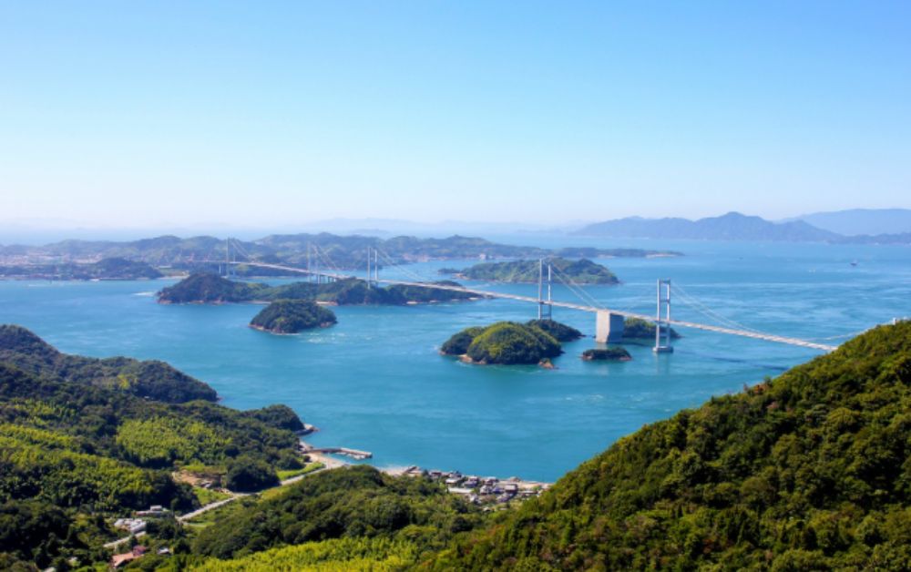
To understand Naoshima, you have to look beyond the island itself. The Seto Inland Sea is not really a sea in the open-ocean sense. It is a chain of drowned valleys, an old continental landscape flooded by the rise of sea level after the last ice age. What looks like dozens of small islands today is in fact a long mountain range whose peaks stayed above water when the lowlands disappeared.
Naoshima is one of those peaks. The granite that forms it is hard, slow to erode, and resistant to the soft surf of the inland sea. That is why the island has its rounded silhouette and its small sheltered bays, instead of the steep cliffs you find on a young volcanic coast. Yakushima’s younger granite tells a parallel story further south, but on a very different scale of age and climate.
The 90-Million-Year-Old Magma Beneath the Museums
The granite of Naoshima is not local. It is a small piece of an enormous magmatic province that runs across most of southwest Japan, from the Inland Sea to the western tip of Honshu. Geologists call it the Sanyo Belt, a continuous band of granite intrusions that cooled in the Late Cretaceous, roughly 90 to 70 million years ago.
At that time, the place we now call Japan was still part of the Asian continent, and a vast oceanic plate called Izanagi was sliding underneath it. The friction and heat of that subduction melted the deep crust, and great bodies of magma rose toward the surface, cooling slowly into the coarse-grained rock that now holds Naoshima above water.
Compared with the very young volcanic stones around Tokyo, this granite belongs to a different chapter entirely. Mount Fuji’s young volcanic stops record the modern arc, still active. Naoshima records the older crust the modern arc was built on.
How Naoshima Granite Shaped the Art
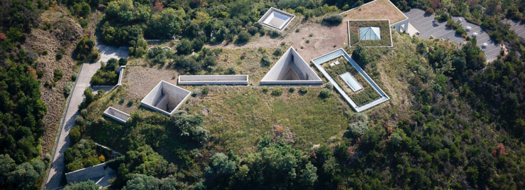
Tadao Ando is famous for working with concrete, but on Naoshima he worked first with the ground. The Chichu Art Museum is buried in the hillside above the southern coast. From the outside, you barely see it. From the inside, daylight falls through narrow concrete shafts onto Monet, Turrell and De Maria. The decision to build downward was not just an aesthetic gesture. It was a way to leave the granite ridge and its trees almost untouched.
The Benesse House pavilions further along the coast follow the same logic at smaller scale. Each building sits on a granite shelf or a cleared cove, never on a flat platform of imported soil. Walk between them and you cross stone steps cut into outcrops, retaining walls that follow natural fractures, terraces that read the rock instead of erasing it.
Researchers at the Geological Survey of Japan have mapped the granitic province of southwest Japan in detail, and the Naoshima outcrops are part of the larger Inland Sea sub-domain. The same rock that forms the floor of an art museum forms the seabed of the strait between the island and Honshu.
Reading the Seto Inland Sea From Naoshima
Climb the small ridge above the village of Honmura, late in the afternoon, and the inland sea opens. Shodoshima to the east, Teshima close by, the silhouette of Honshu in the haze. Each visible island is another granite peak. Each blue channel between them is a drowned valley. The view is calm and almost domestic, but it is also a tectonic map, drawn at low contrast.
This region does not feel dangerous in the way Hakone’s caldera landscape feels dangerous. There are no sulphur vents on Naoshima, no boiling rivers, no recent eruptions. The geology of the Inland Sea is old, settled, slow. It is the kind of land that lets art rest on it for a few decades without flinching.
For the wider Places picture across the country, see the Japan’s most geologically significant places.
Frequently Asked Questions
When is the best time to visit Naoshima for both the art and the landscape?
Late spring (April to early June) and autumn (October to mid-November) give the clearest light on the sea and the most comfortable walking conditions on the granite paths. Avoid Tuesdays, when many of the museums are closed.
How can I read the rock without being a geologist?
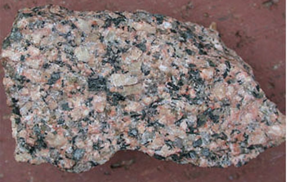
Look for three things on the coast: the pinkish-grey colour of the stone, the visible quartz crystals when sunlight hits a fresh surface, and the way the rock weathers into rounded blocks instead of sharp angular fragments. Those three signs together say granite.
Are the other Setouchi art islands also granite?
Most of them, yes. Teshima, Inujima and Shodoshima all sit on the same Cretaceous granitic province. Each one is a slightly different chapter of the same long story, and the Setouchi Triennale festival has slowly turned that geological coherence into an artistic one.
About the Author
Daniel writes for Geonatra from the field, reading landscapes the way others read libraries. His Setouchi notebooks were filled walking the granite shores of Naoshima, the terraced coves of Teshima and the quiet ridges of Shodoshima, with one thought returning: how an old, patient rock can hold an entire conversation between art and the Earth.