
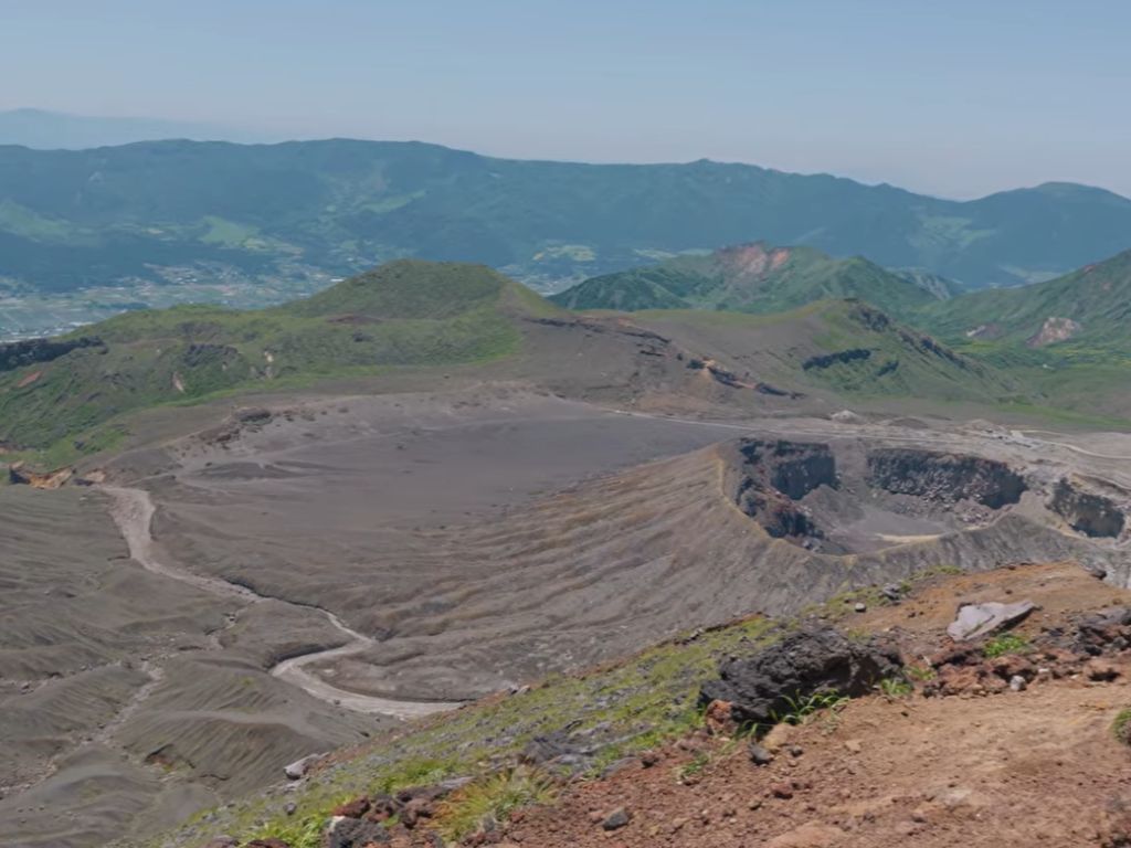
Kyushu volcanoes shape every dawn on this island. Six in the morning, on the rim of Aso. The wind carries volcanic dust thirty kilometres west, and the rising sun pulls the crater walls out of shadow one ridge at a time. From this point the caldera looks almost domestic: rice terraces, a road, a Japan Railways line running quietly across the bottom, a few thousand cattle grazing.
It takes a moment to register the scale. The far wall of the bowl is twenty-five kilometres away. The fields, the cars and the train are all standing inside the volcano, on the floor of an old collapse. Nearly fifty thousand people live here. They commute, plant rice, raise children, and fill their cars at petrol stations built directly above one of the largest active magma systems in the world.
Kyushu Volcanoes: A Quick Overview
The kyushu geology volcanic island story begins with subduction. The Philippine Sea Plate slides beneath the southern arc of Japan, and the result is one of the densest concentrations of active volcanism on Earth. Aso, Sakurajima, Unzen and Kirishima all hold daily activity, while Beppu releases the same heat through its hot springs.
The Caldera You Live Inside
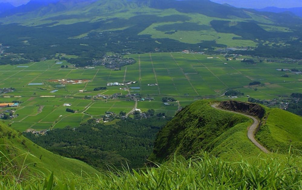
Aso is not a single mountain. It is a basin, twenty-five kilometres long and eighteen wide, formed by four major caldera collapses between three hundred thousand and ninety thousand years ago. The largest emptied around six hundred cubic kilometres of magma in a single eruption, more than enough to bury much of central Kyushu in pyroclastic flow.
What collapsed then is what people farm now. Volcanic ash makes some of the most fertile soils on the planet, and the floor of the caldera became, over millennia, a long sunlit valley of rice paddies, cattle pasture and wooden houses. Nakadake, the only currently active cone of the five central peaks, sends a thin column of gas into the sky most days. Visitors can drive almost to its rim. The summit road closes when sulphur dioxide rises above safety thresholds, which happens many times a year, and reopens when the gas falls again
Kyushu Volcanoes: A Quick Overview
The kyushu geology volcanic island story begins with subduction. The Philippine Sea Plate slides beneath the southern arc of Japan, and the result is one of the densest concentrations of active volcanism on Earth. Aso, Sakurajima, Unzen and Kirishima all hold daily activity, while Beppu releases the same heat through its hot springs.
The Caldera You Live Inside
Aso is not a single mountain. It is a basin, twenty-five kilometres long and eighteen wide, formed by four major caldera collapses between three hundred thousand and ninety thousand years ago. The largest emptied around six hundred cubic kilometres of magma in a single eruption, more than enough to bury much of central Kyushu in pyroclastic flow.
What collapsed then is what people farm now. Volcanic ash makes some of the most fertile soils on the planet, and the floor of the caldera became, over millennia, a long sunlit valley of rice paddies, cattle pasture and wooden houses. Nakadake, the only currently active cone of the five central peaks, sends a thin column of gas into the sky most days. Visitors can drive almost to its rim. The summit road closes when sulphur dioxide rises above safety thresholds, which happens many times a year, and reopens when the gas falls again.The caldera is the same geological idea Hakone teaches further north, simply on a much larger scale. Aso is what a caldera looks like when its walls are old enough, weathered enough and wide enough to hold a small civilisation inside them. Living there is not foolhardiness. It is the result of generations of practical knowledge about what the volcano does, when, and how to read its quieter signs. The same magma that occasionally threatens the region also makes its soils some of the richest in Japan, and the same heat that fuels its volcanoes also drives its hot springs and its agriculture.
Kyushu Volcanoes: Sakurajima and Shimabara
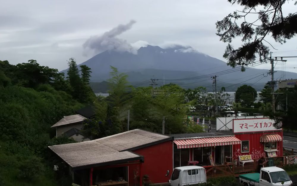
Sakurajima sits across the bay from Kagoshima, a city of six hundred thousand people. The volcano erupts almost every day. Since 1955 it has produced minor explosive activity on a near-continuous basis, and the locals have worked out a rhythm with it: ash forecasts on the morning news, plastic covers for cars, schoolchildren walking to class under yellow helmets.In 1914 a much larger eruption joined Sakurajima to the mainland. What had been an island until that year became a peninsula in a few weeks of lava flow. The connection has held ever since, and the volcano has remained one of the most closely monitored in the world. The Japan Meteorological Agency operates dedicated observatories around its base, and the alert system is calibrated to allow Kagoshima to function normally during persistent low-level activity. A few hours west, the Unzen volcanic complex tells a darker chapter. In 1792 a partial collapse of one of its domes triggered a tsunami that killed about fifteen thousand people on the opposite shore of the Ariake Sea. It remains the deadliest volcanic event in Japanese history. The hill that fell, Mayuyama, is still visible above the town of Shimabara, its scar partially regrown.
Read together, Sakurajima and Unzen describe the southern bend of Japan’s place on the Ring of Fire. They are not separate accidents. They sit on the same line of subduction, the same melt zone in the mantle wedge, the same delivery system pushing magma upward at slightly different rates and slightly different chemistries. To stand on the harbour at Kagoshima and see Sakurajima exhaling in the distance is to look directly at the engine that powers the southern arc.
Kyushu Volcanoes: Beppu’s Heat from Below
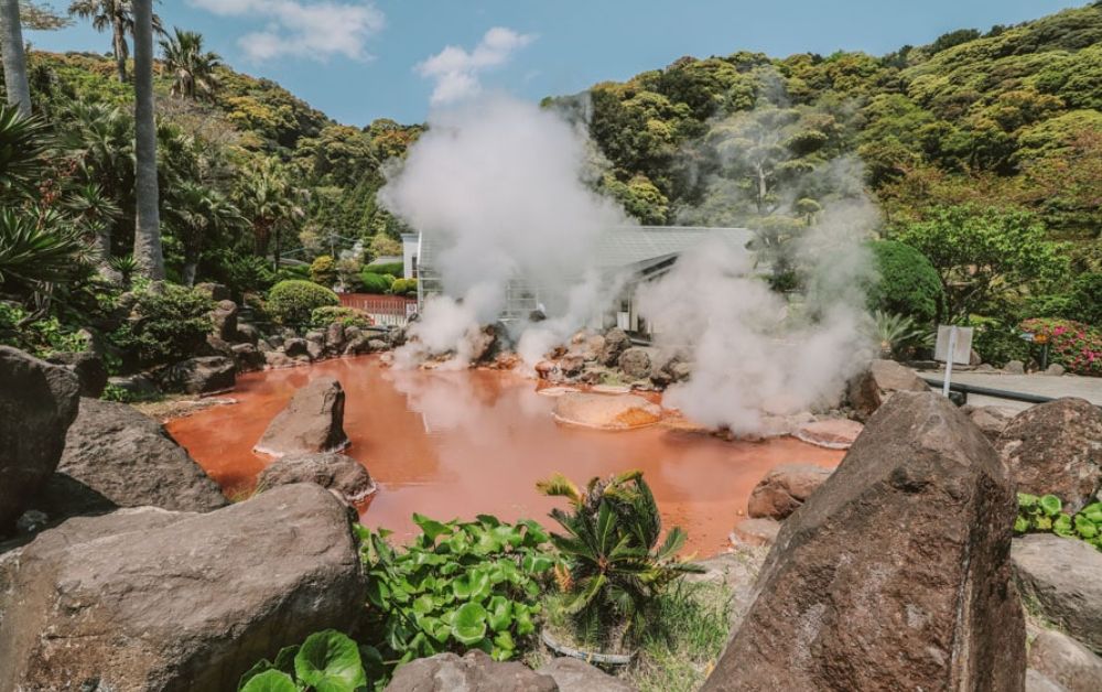
On the eastern coast of Kyushu, Beppu releases the same magmatic heat in a different form. The town pumps roughly one hundred and thirty thousand cubic metres of geothermal water every day, second only to Yellowstone. There are around two thousand eight hundred registered springs in the Beppu area alone, each with its own chemistry, temperature and depth.
The local tradition organises eight of the most spectacular sources into a circuit known as jigoku, the hells: cobalt blue at Umi Jigoku, blood red at Chinoike Jigoku, mud bubbles at Oniishibōzu Jigoku. They are not bathing pools. They are observation pools, kept too hot or too acidic for soaking, and they show what the deeper part of every nearby onsen actually looks like before it cools and is piped to inn baths.
Beppu’s heat comes from the same subduction that built Mount Fuji further north, only here the southern arc is so volcanically active that the geothermal expression reaches the surface almost everywhere. Some hotels are heated entirely by ground steam. Some agricultural greenhouses are too. The Smithsonian Global Volcanism Program lists Kyushu’s active volcanoes alongside the most monitored systems in the world, and the geothermal map of Beppu reads almost as a coda to that volcanic activity.
Across Aso, Sakurajima and Beppu, the island repeats the same lesson at three different levels of intensity. For the wider road-trip view of how this fits into a Japan-wide journey.
Frequently Asked Questions
Is it safe to visit Aso or Sakurajima?
Mostly yes, under monitored conditions. The Japan Meteorological Agency operates a five-level volcanic alert system, and access to summit areas is closed during higher levels. Visitors normally enter Aso’s central crater road only when sulphur dioxide is below safe thresholds. Sakurajima can be approached from observation points across the bay regardless of the day’s activity.
Which volcano in Kyushu is the most active?
Sakurajima, by frequency. It produces minor explosive eruptions almost daily and has been continuously active since 1955. Aso’s Nakadake is the most consistently degassing, while Unzen, Kirishima and the more distant Kuchinoerabu-jima volcanoes alternate longer dormant phases with significant eruptive episodes.
Can you actually drive through a caldera in Kyushu?
Yes, Aso is the standard example. National Route 57 and the JR Hohi Main Line both cross the floor of the caldera. Towns, schools, hospitals and rice fields fill the inner basin, all of them effectively located inside the volcano.
About the Author
Daniel Parker writes for Geonatra from the field, reading landscapes the way others read libraries. His Kyushu notebooks were filled at the rim of Aso, on the harbour at Kagoshima with Sakurajima exhaling in the distance, and beside the steam of Beppu’s pools, asking how an island this active could feel this calm.