
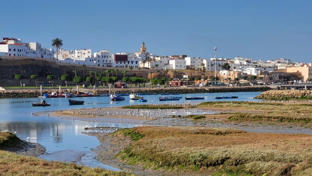
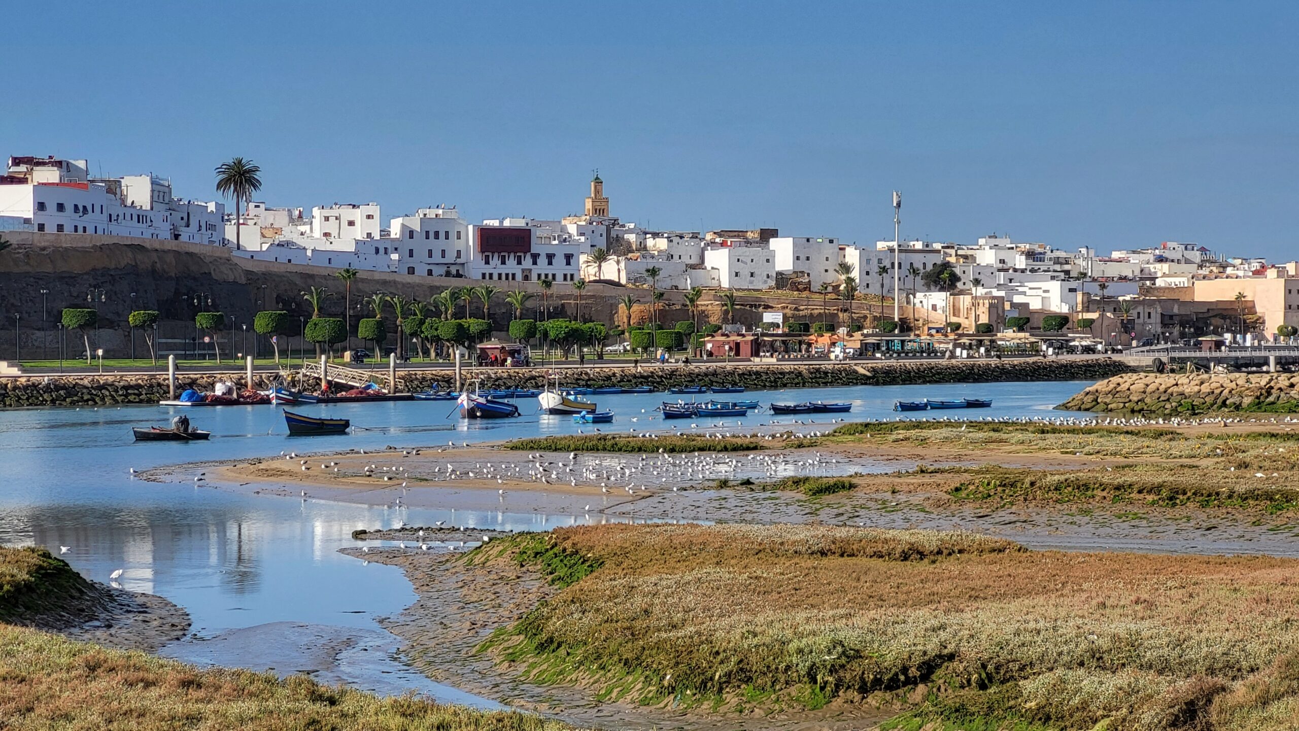
Step down to the riverbed of the Bou Regreg in the middle of Rabat, and the concrete embankments give way to bare rock, dark pillow-shaped lava and pale granite, worn smooth by traffic and tide rather than by any hiking boot. Most of the people crossing the bridge overhead have no reason to look down. Morocco’s capital sits on one of the oldest, quietest corpses in Morocco geology, a mountain range that finished dying so long ago it never earned a name on a tourist map.
Three hundred kilometers south, near Marrakech, a much younger version of the same story is still playing out. There, low ranges of broken hills still show their ribs above the sand, crossed by quad bikes and camel trains, not yet ground down to nothing. Morocco geology tells one long story of mountains built, worn away and finally erased, and the country’s biggest cities happen to sit at very different chapters of it.
What Is Morocco Geology in the Meseta Region?
Morocco geology in the Meseta region describes the eroded remains of a mountain belt built during the Hercynian collision, roughly 360 to 300 million years ago. The Meseta splits into a western half, stretching from Rabat and Casablanca to Marrakech, and an eastern half near the Algerian border. Its rock underlies some of Morocco’s largest cities, even where no mountain is visible above ground.
An Ocean Closes and an Arc of Volcanoes Rises
This chapter of Morocco geology begins in the Devonian and Carboniferous periods, when an ancient ocean separating two continental blocks began to close. As the seafloor slid beneath the advancing crust, it triggered a chain of volcanoes along the eastern edge of what would become the Meseta, an island arc not unlike the ones that ring parts of the Pacific today.
Molten rock rose in pulses, some of it reaching the surface as ash and lava, some of it cooling slowly underground into granite that would only be exposed millions of years later, once everything above it had worn away. Geologists studying this corner of Morocco geology, around the Debdou and Mekkam massifs, still find the folded, faulted remnants of that arc today, along with red volcanic sediment that settled in the basins beside it.
Further west, this chapter of Morocco geology closed harder and later, thickening the crust into a true mountain range, comparable in scale to ranges like the Appalachians or the early Alps. This was not a quiet, gradual process. Faults slipped, rock folded into tight chevrons, and entire slabs of older seafloor were thrust up and over younger sediment, a signature that geologists can still read in outcrop after outcrop across the region. By the time the collision finished, close to 300 million years ago, Morocco had gained a mountain belt that stretched from the Atlantic coast to the edges of the Sahara, standing far taller than anything that walks across it today.
The Mountains Still Dying in Plain Sight, Next to Marrakech
Morocco geology does not erode evenly. Not every part of that range died at the same pace. Forty minutes from Marrakech, one of Morocco’s most visited cities, the Jbilet Hills still break the horizon in low, broken ridges, their folded rock exposed to wind and quad tires rather than buried under sediment. A short drive further west, the Rehamna massif shows the same thing on a larger scale, bare hills and shallow valleys where the old mountain belt has not yet finished eroding away.
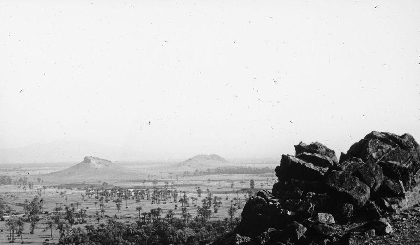
Geologists divide both areas into western, central and eastern blocks, each recording a slightly different depth of folding and heat from the original collision. The rock here has spent three hundred million years exposed to rain, wind and the occasional flash flood, and it shows. Ridgelines have softened into rounded backs. Valleys have widened. But the bones are still visible, still climbable, still crossed by hikers, camel trains and the buggy tours that now bring visitors out from Marrakech for an afternoon.
In Morocco geology, this is what a mountain range in its final stretch of life looks like from the ground. It is also, less romantically, a working landscape. The same folding that lifted these hills concentrated metal in their rock, and mines at Kettara and Koudiat Aïcha in the Jbilet, and at Benguerir in the Rehamna, have pulled ore and phosphate from this ground for most of the past century. Marrakech’s desert excursions, its phosphate trains and its quad tracks all sit, without most visitors realizing it, on the last visible ribs of a mountain range that has almost, but not quite, finished dying.
Then the Mountains Disappear Completely, Under Rabat and Casablanca
Travel three hundred kilometers north and the same chapter of Morocco geology tells a very different story. Around Rabat, Salé and Casablanca, nothing breaks the skyline. The land is flat enough to build a capital, an airport and a coastline of ports without a single quarry blasting through solid rock. That flatness is not an accident of geography. It is the final stage of the same erosion visible, mid-process, in the Jbilet and Rehamna hills further south.
Here, the mountain belt has been worn down so completely that its rock only surfaces where a river has cut deep enough to expose it, as it does in the bed of the Bou Regreg through central Rabat, or where a road cutting or quarry happens to slice into the buried basement. The Sehoul block, a sliver of crust fused onto the mountain belt during its earliest stage of collision, sits directly beneath the modern city, its granite and metamorphic rock hidden under a thin blanket of younger river gravel and marine sediment, one of the oldest fragments in Morocco geology still hiding beneath a modern capital. Dated to the Cambrian and Ordovician, the block counts as old within the Meseta, though it is still young next to the three-billion-year basement exposed far to the south in Morocco’s West African Craton.
A few kilometers away, at Casablanca, a similar coastal strip of Meseta rock disappears beneath Cenozoic limestone and Quaternary dune sand, the platform on which the country’s largest port and its busiest highways were built. Neither city advertises this. There is no sign on the airport road announcing that travelers are driving over the root of a vanished mountain range. But the rock is there, pressed flat, patient, doing the quiet structural work of holding up two of the largest urban populations in North Africa. If the Jbilet Hills show what a mountain range looks like while it is still dying, Rabat and Casablanca show what is left once it finally has.
The Fire Never Fully Went Out
None of this means Morocco geology went silent once the mountains stopped rising. Red volcanic sediment settled across parts of the region during the Permian, laid down by eruptions that punctuated the early stages of erosion rather than the original mountain-building. Far more surprising, given how old the surrounding rock is, are the basalt flows near the Oued Boulahmayel and at Jbel Hadid, dated to the Quaternary, the geological period that includes the present day.
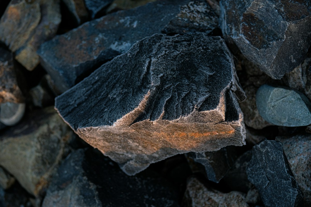
These flows are young enough to postdate nearly all of subsequent Moroccan history, human and geological alike, proof that the deep structure beneath the Meseta was never entirely finished with volcanism, even as the mountains above it wore down to nothing. According to Morocco’s national mining authority, ONHYM, the country’s structural domains remain active areas of geological mapping precisely because their history is layered rather than simple, old collision zones with pockets of much younger activity still recorded in the rock. A mountain range can finish dying and still, here and there, catch fire one more time.
One Region, Many Stories Still to Tell
This corner of Morocco geology rewards close attention because the Meseta, more than most Moroccan regions, splits cleanly into two very different domains. The western Meseta, the one carrying Rabat, Casablanca, Marrakech and its desert hills, sits closer to the Atlantic and experienced a gentler, more extensional style of deformation. The eastern Meseta, isolated in small, scattered outcrops around Debdou and Mekkam near the Algerian border, tells a rougher, more compressed version of the same collision, tightly folded and metamorphosed rock with almost none of the western half’s tourism infrastructure. Both halves belong to the same mountain-building event, viewed from opposite ends of a very long life.
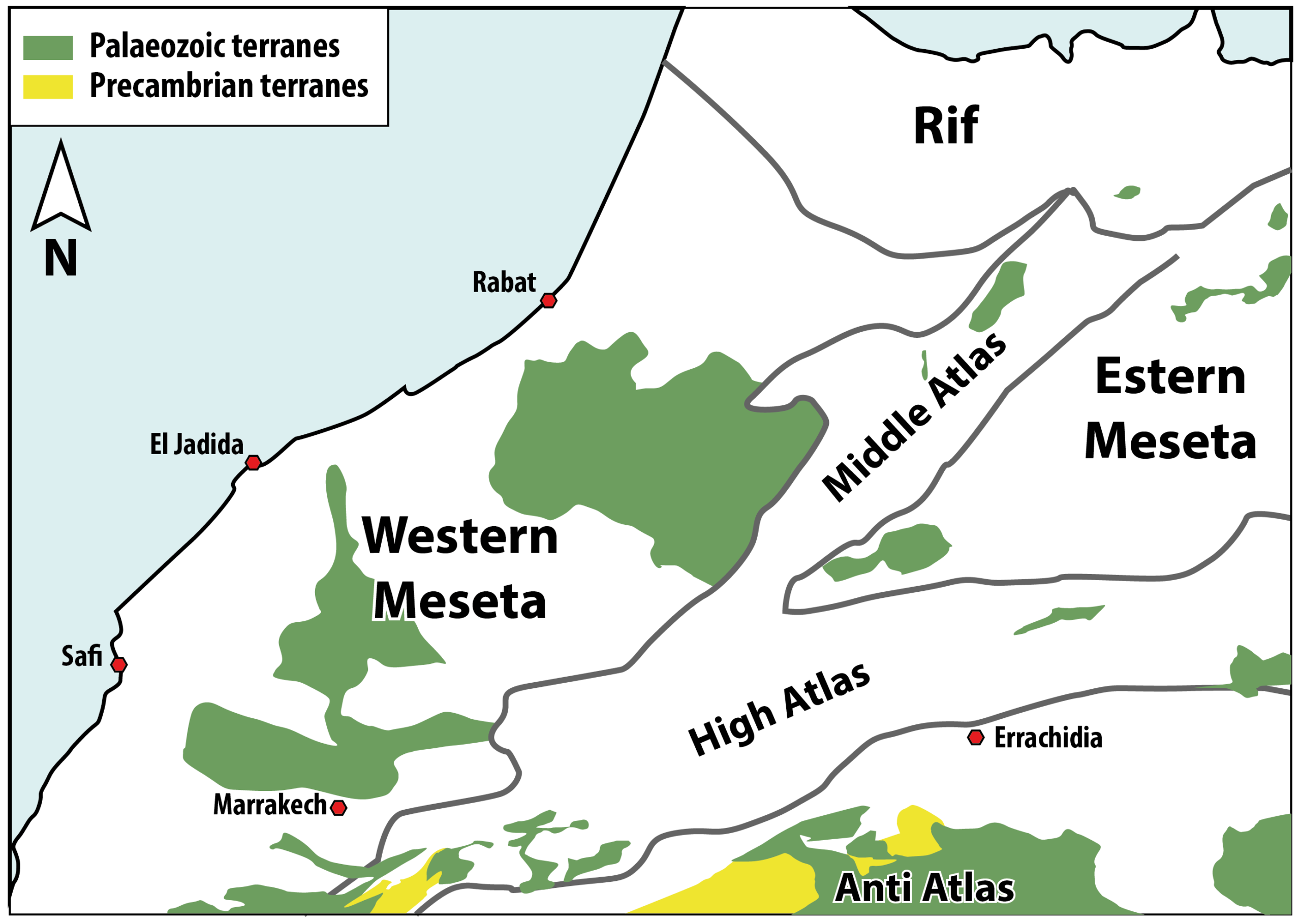
A similar contrast plays out further south, in the Anti-Atlas Geology overview and the wider Atlas Mountains hub, each domain telling its own version of Morocco’s long tectonic history in its own rhythm of dying mountains and rising ones.
What follows in the rest of this story, told place by place across the Meseta, is the detail waiting in each of these six corners: the Marrakech desert excursion across the Jbilet Hills still crossed by quad tours, the Benguerir phosphate mine in the Rehamna feeding a global industry, the Oulmès mineral water still rising through three-hundred-million-year-old granite, the granite hidden under Rabat and Salé, the volcanism at Khénifra where old rock meets young lava, and the quiet eastern Meseta around Debdou and Mekkam that almost no one visits at all.
Frequently Asked Questions
Why don’t Rabat and Casablanca have visible mountains if they sit on an old mountain range? In Morocco geology, three hundred million years of erosion wore the range down to a flat plain before either city existed. The rock is still there underground, and occasionally exposed in riverbeds or quarries, but no ridge survived on the surface.
Are the Jbilet and Rehamna hills part of the same mountain range as the rock under Rabat? Yes. Both are pieces of the same Hercynian collision, just at an earlier stage of erosion. The Jbilet and Rehamna hills near Marrakech still show broken ridges above ground, while the equivalent rock further north has already worn flat.
Is the Meseta still geologically active today? Not in the way the Atlas Mountains or the Rif are, where earthquakes and active uplift continue. But Quaternary basalt flows near Khénifra show that volcanism in the Meseta continued long after the main mountain-building event ended, and parts of the region are still being actively mapped for their mineral resources.
About the Author
Daniel has walked the Bou Regreg riverbed in Rabat and ridden quad trails through the Jbilet Hills outside Marrakech within the same week, struck each time by how differently the same mountain range can age. He writes this pillar as the starting point for a longer look at the Meseta, one town, one mine and one outcrop at a time.